Cruising Guides - Greece: Navigation and Marinas

Explore the best guides for cruising holidays in Greece. Discover Imray, Adlard Coles and other cruising guides that inform you bout navigation, marinas and tourist sights in Greece.

Independent book recommendations! Purchases made through our links support our work - at no extra cost to you. Learn more >

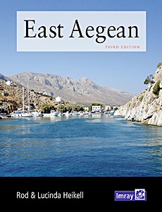
East Aegean - Greek Dodecanese islands and the Turkish coast from the Samos Strait as far east as Kas and Kekova

The expanded third edition of this popular cruising guide encompasses the Greek Dodecanese islands and the Turkish coast eastwards from the Samos Strait to Kas and Kekova.
Fully illustrated with up to date plans and numerous new photographs, it is packed with all the essential information for getting to the area, formalities and sailing these beautiful cruising grounds.

There is a level of further detail to this coverage in terms of anchorages and other destinations than is found in the Heikell's Greek Waters Pilot and Turkish Waters and Cyprus Pilot. This handy guide also whets the appetite for the local cuisine and culture and gives some historic context to exploration ashore.

Product details

Author:Rod Heikell, Lucinda Heikell
Details:310 pages, 9.7 x 7.5 x 0.87 in (24.5 x 19 x 2.2 cm), hardback
Illustrations:many colour photos and maps
Language:English
Publisher:Imray, Laurie, Norie & Wilson Ltd (GB, 2021)
ISBN:9781786791788
Book cover: East Aegean - Greek Dodecanese islands and the Turkish coast from the Samos Strait as far east as Kas and Kekova | Imray

East Aegean - Greek Dodecanese islands and the Turkish coast from the Samos Strait as far east as Kas and Kekova

Language: English

Check price and availability:

Greek Waters Pilot (15th Edition)

NEW

"Greek Waters Pilot" by Rod and Lucinda Heikell is a comprehensive cruising guide to the coasts and islands of Greece, covering the Ionian Islands, the Aegean, Rhodes and Crete. It provides detailed information on more than 450 harbours and anchorages in a single volume.

Compiled from the authors' own surveys and explorations over four decades, together with first-hand reports from a network of contributors, the guide offers practical information for planning and navigating coastal passages, selecting anchorages and visiting ports throughout Greece. The fifteenth edition has been extensively updated to reflect changes across the region.

Alongside its navigational and pilotage information, the book includes background on Greek history, mythology, local culture and gastronomy. It is a reference guide for cruising sailors planning to explore Greek waters, whether on extended voyages or shorter sailing trips.

Product details

Author:Rod Heikell, Lucinda Heikell
Details:544 pages, 12 x 8.7 x 1.26 in (30.5 x 22 x 3.2 cm), hardback
Illustrations:many colour photos and maps
Language:English
Publisher:Imray, Laurie, Norie & Wilson Ltd (GB, 2025)
ISBN:9781786795878
Book cover: Greek Waters Pilot (15th Edition) | Imray

Greek Waters Pilot (15th Edition)

Language: English

Check price and availability:

West Aegean (5th Edition)

NEW

Rod and Lucinda Heikell's "West Aegean" is a sailing guide covering the coasts and islands around Athens, the Cyclades and the eastern Peloponnese as far as Monemvasia. It also describes the Greek mainland coast from Cape Sounion to Volos, the adjacent coast of Evia, and the Northern Sporades, including Skiathos and Skopelos.

Designed as a companion to "Greek Waters Pilot", this guide provides detailed information on destinations covered only briefly in the main pilot book. It is particularly useful for charterers, flotilla sailors and other sailors exploring the region. In addition to practical sailing information, it covers local transport, shore excursions, places of interest, Greek food and wine, classical history and ancient sites.

The guide combines the authors' pilotage notes with harbour plans and photographs, many taken by Lucinda Heikell, to support navigation and help sailors plan their visits to the ports, islands and coastal destinations of the West Aegean.

Product details

Author:Rod Heikell, Lucinda Heikell
Details:191 pages, 9.7 x 7.5 x 0.71 in (24.5 x 19 x 1.8 cm), paperback
Illustrations:many colour photos and maps
Language:English
Publisher:Imray, Laurie, Norie & Wilson Ltd (GB, 2025)
ISBN:9781786795861
Book cover: West Aegean (5th Edition) | Imray

West Aegean (5th Edition)

Language: English

Check price and availability:
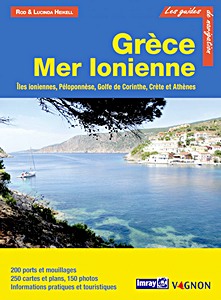
Grèce - Mer Ionienne - Îles Ioniennes, Péloponnèse, Golfe de Corinthe, Crète et Athènes (Guide Imray Vagnon)

For each port, island or bay, the reader will find a complete and detailed description, cartography, day and night approaches, moorings and anchorages, equipment and services, or even visits to be made on land.
This guide covers the Ionian Islands, the Peloponnese, the Gulf of Corinth, Crete and Athens.

The Vagnon guides are the French adaptation of the works of the prestigious English publishing house Imray, a world reference in the field of marine cartography. They describe with unequalled precision the ports, marinas, anchorages...
Their clear presentation, with many photos complementing numerous maps and detailed plans make them essential works for successful cruises.

Product details

Author:Rod Heikell, Lucinda Heikell
Details:288 pages, 11.2 x 8.25 x 0.75 in (28.5 x 21 x 1.9 cm), paperback
Illustrations:many colour photos and maps
Language:French
Publisher:Editions Vagnon (F, 2019)
Series:Guide Imray Vagnon
ISBN:9791027103669
Book cover: Grèce - Mer Ionienne - Îles Ioniennes, Péloponnèse, Golfe de Corinthe, Crète et Athènes | Guide Imray Vagnon | Vagnon

Grèce - Mer Ionienne - Îles Ioniennes, Péloponnèse, Golfe de Corinthe, Crète et Athènes

Language: French

Check price and availability:
Hafenguide Griechenland 1: Ionisches Meer - Peloponnes - Golf von - Korinth - Athen - Saronischer Golf - Albanien

"Hafenguide Griechenland 1" is a practical harbour guide for sailing along the western coast of Greece and the surrounding islands. It covers the Ionian Sea, the Peloponnese, the Gulf of Corinth, Athens, the Saronic Gulf and Albania.
Each harbour is presented on an A4 page with an aerial photograph, harbour plan and description, providing information on harbour approaches, mooring facilities and local services.
The guide also includes cultural background information, sightseeing recommendations and suggestions for shore excursions.

With more than 300 illustrations, 11 maps and 237 detailed harbour plans, it supports both voyage planning and navigation during a sailing trip. Its A4 format and spiral binding make it suitable for use aboard a yacht as well as at home when planning a sailing holiday in Greece.

Product details

Author:Per Hotvedt, Jørn Engevik, Hanne Engevik
Details:268 pages, 11.8 x 9.1 x 0.94 in (30 x 23 x 2.4 cm), spiral binding
Illustrations:304 photos, 237 harbour maps, 11 maps
Language:German
Publisher:Delius Klasing Verlag GmbH (D, 2020)
ISBN:9783667115119
Book cover: Hafenguide Griechenland 1: Ionisches Meer - Peloponnes - Golf von - Korinth - Athen - Saronischer Golf - Albanien | Delius Klasing

Hafenguide Griechenland 1: Ionisches Meer - Peloponnes - Golf von - Korinth - Athen - Saronischer Golf - Albanien

Language: German

Check price and availability:
Küstenhandbuch Griechische Küsten - Häfen und Ankerplätze

NEW

The "Griechische Küsten" nautical guide is your ultimate resource for planning and executing a sailing trip through Greece's stunning waters. With 13.000 kilometers of coastline and 2.000 islands, Greece offers ideal routes for both relaxed family vacations and adventurous crews, featuring short distances, calm waters, ancient ruins, authentic fishing ports, and secluded bays.

Author Rod Heikell, an experienced sailor with a deep passion for the Mediterranean, shares his extensive knowledge in this comprehensive guide. It includes essential planning information such as history, formalities, radio communication, marine life, and weather.
The book covers Greece's most beautiful sailing regions, including the Ionian Sea, Peloponnese, Gulf of Corinth, Saronic Gulf, Cyclades, Sporades, Dodecanese, and Crete.

With route suggestions, sea charts, waypoints, and GPS data, as well as details on major ports, marinas, berthing options, and supply facilities, this guide ensures easy orientation during your voyage. It also provides leisure tips and highlights must-see attractions.

This is the German edition of the Imray book "Greek Waters Pilot (13th edition)". Set sail and experience an unforgettable Greek adventure.

Product details

Author:Rod Heikell, Lucinda Heikell
Details:644 pages, 12 x 8.5 x 1.69 in (30.5 x 21.5 x 4.3 cm), paperback
Illustrations:343 colour photos, 526 maps
Language:German
Publisher:Edition Maritim (D, 2026)
ISBN:9783667129482
Book cover: Küstenhandbuch Griechische Küsten - Häfen und Ankerplätze | Edition Maritim

Küstenhandbuch Griechische Küsten - Häfen und Ankerplätze

Language: German

Check price and availability:
Törnführer Griechenland 1: Ionische Inseln, Golf von Patras und Korinth, Peloponnes, Argolischer und Saronischer Golf

This sailing guide covers the Greek coastline from Corfu to Athens, including the Ionian Islands, western mainland Greece, the Gulf of Patras, the Gulf of Corinth, the Peloponnese, the Argolic Gulf, the Saronic Gulf and the coast of Attica. It provides detailed descriptions of the main harbours, marinas and anchorages, supported by harbour plans and photographs to assist with route planning and navigation.

The guide also includes information on local facilities and sightseeing opportunities, helping sailors plan shore visits and explore the region's cultural attractions. This fully updated 11th edition is a practical reference for planning independent sailing trips along the southwestern Greek coast and its islands.

Product details

Author:Gerd Radspieler, Melanie Haselhorst, Kenneth Dittmann
Details:320 pages, 9 x 6.5 x 1.06 in (24 x 16.5 x 2.7 cm), paperback
Illustrations:135 photos, 188 maps in colour
Language:German
Publisher:Delius Klasing Verlag GmbH (D, 2024)
ISBN:9783667123824
Book cover: Törnführer Griechenland 1: Ionische Inseln, Golf von Patras und Korinth, Peloponnes, Argolischer und Saronischer Golf | Delius Klasing

Törnführer Griechenland 1: Ionische Inseln, Golf von Patras und Korinth, Peloponnes, Argolischer und Saronischer Golf

Language: German

Check price and availability:
Törnführer Griechenland 2: Attikaküste - Petalischer Golf - Südlicher Euböa-Golf - Südteil von Euböa - Kykladen

This sailing guide covers four Greek cruising areas: the coast of Attica, the Petalioi Gulf, Euboea and the Cyclades. Designed for motorboat and sailing yacht owners, it provides suggested routes and practical information for planning cruises and navigating between harbours and islands.

Detailed harbour descriptions cover approaches, mooring facilities and local services, supported by plans and photographs to assist navigation. The guide also includes information for sailors, sightseeing recommendations and suggestions for shore excursions, including trips around Athens and the Gulf of Euboea.

Originally written by Gerd Radspieler, this revised edition has been updated by Mediterranean specialists Melanie Haselhorst and Kenneth Dittmann. It is a practical reference for planning and undertaking a boating holiday in Greece.

Product details

Author:Terd Radspieler, Melanie Haselhorst, Kenneth Dittmann
Details:240 pages, 9 x 6.5 x 0.67 in (24 x 16.5 x 1.7 cm), paperback
Illustrations:97 photos, 160+ maps
Language:German
Publisher:Delius Klasing Verlag GmbH (D, 2021)
ISBN:9783667119391
Book cover: Törnführer Griechenland 2: Attikaküste - Petalischer Golf - Südlicher Euböa-Golf - Südteil von Euböa - Kykladen | Delius Klasing

Törnführer Griechenland 2: Attikaküste - Petalischer Golf - Südlicher Euböa-Golf - Südteil von Euböa - Kykladen

Language: German

Check price and availability:

Törnführer Griechenland 3 - Ostägäische Inseln - Dodekanes - Kreta

This sailing guide covers the eastern Aegean islands, the Dodecanese and Crete, including destinations such as Samos, Chios, Ikaria, Rhodes and Kos. It provides detailed harbour information for planning sailing trips, with descriptions of harbour approaches, mooring facilities, local services and provisions, supported by harbour plans and photographs.
Practical information for sailors includes currents, winds, water depths and harbour fees, as well as local regulations and customs. The guide also describes sightseeing opportunities and shore excursions on Crete, Rhodes and other Greek islands.

Originally written by Gerd Radspieler, this revised edition has been updated by Greece specialists Melanie Haselhorst and Kenneth Dittmann. It is a practical reference for planning yacht cruises in the Greek Aegean.

Product details

Author:Gerd Radspieler, Melanie Haselhorst, Kenneth Dittmann
Details:272 pages, 9 x 6.5 x 0.67 in (24 x 16.5 x 1.7 cm), paperback
Illustrations:136 photos, 177 maps in colour
Language:German
Publisher:Delius Klasing Verlag GmbH (D, 2020)
ISBN:9783667115034
Book cover: Törnführer Griechenland 3 - Ostägäische Inseln - Dodekanes - Kreta | Delius Klasing

Törnführer Griechenland 3 - Ostägäische Inseln - Dodekanes - Kreta

Language: German

Check price and availability:

Related Titles:

Book cover: The Adlard Coles Book of Mediterranean Cruising (5th edition) | Adlard Coles

The Adlard Coles Book of Mediterranean Cruising (5th edition)

Rod Heikell, Lucinda Heikell | English | paperback | 208 p. | 2023

Book cover: Mediterranean Weather Handbook for Sailors

Mediterranean Weather Handbook for Sailors

Roberto Ritossa | English | paperback | 120 p. | 2014

Book cover: Mediterranean Cruising Handbook (6th edition)

Mediterranean Cruising Handbook (6th edition)

Rod Heikell, Lucinda Heikell | English | paperback | 280 p. | 2012