Przewodniki żeglarskie - Szkocja: nawigacja i mariny
Przewodnik żeglarski na rejs w Szkocji? Znajdziesz tu przewodniki, które informują o nawigacji, portach jachtowych i atrakcjach turystycznych w Szkocji.
CCC Sailing Directions - Kintyre to Ardnamurchan
The area covered by this cruising guide stretches northwards from the Mull of Kintyre to the Ardamurchan peninsula, detailing some of the finest cruising grounds to be found anywhere in the world. Within easy reach of all the main harbours and marinas lie an abundance of lochs and islands with numerous idyllic anchorages to explore. Some of these are easy to find, others pose more of a navigational challenge and are accessed via intricate channels using a series of well-described transits, others lie beyond turbulent tidal sounds. All reward with stunning scenery and there is somewhere for everyone, whether on a first-time visit, or a return to familiar waters.
This new edition, updated by Edward Mason, continues the long-respected legacy of CCC publications for cruising sailors. Information on harbours and marinas has been thoroughly revised, and plans have been updated throughout. Several new photographs have been included to help to identify key navigational features as well as to entice further exploration.
Details on plans have been updated with reference to the Imray chart pack for the area (2800 Kintyre to Ardnamurchan). References to Bob Bradfield's useful Antares large scale charts are also included. Supplements are available to download from the club's website.
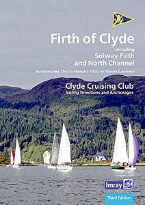
CCC Sailing Directions - Firth of Clyde - Including Solway Firth and North Channel
Part of the Clyde Cruising Club's Sailing Directions and Anchorages series, Firth of Clyde extends beyond its titled area to the coast of Northern Ireland (Rathlin Island to Belfast Lough) and on the Scottish side southwards from Stranraer to Portpatrick and beyond to the Solway Firth and Cumbria. This book covers everything from the busy waters of the Firth of Clyde and River Clyde to the more remote areas of the wider estuary and connected lochs, including the protected and beautiful Kyles of Bute and Loch Riddon, Loch Fyne and the Crinan Canal. Coverage then extends west and south to encompass North Channel and Solway Firth.
This new edition, updated by Geoff Crowley, continues the long-respected legacy of CCC publications for cruising sailors. The North Channel section has been extended to include details for Belfast itself. New photographs throughout illustrate the text and help orientate the navigator. Details on plans have been updated with reference to the new Imray 2900 Firth of Clyde chart pack for the area. References to Bob Bradfield's useful Antares large scale charts are also included. Whether you are a local sailor or a first-time cruising visitor, Firth of Clyde is an essential companion in these waters. Updates and corrections are available via the Clyde Cruising Club website.
Szczegóły
Autor:
Clyde Cruising Club, Geoff Crowley
Wydanie:
150 strony, 29.5 x 21 x 1 cm, wiązanie spiralne
Ilustracje:
bogato ilustrowane, kolorowych zdjęć i mapy
Wydawca:
Imray, Laurie, Norie & Wilson Ltd (GB, 2020)
ISBN:
9781786791641
CCC Sailing Directions - Firth of Clyde - Including Solway Firth and North Channel
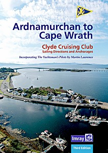
CCC Sailing Directions - Ardnamurchan to Cape Wrath
The area covered by this cruising guide includes the northern section of the West Coast of Scotland from Ardnamurchan Point to Cape Wrath, including the whole of Skye and the Small Isles. The intricate and stunning coastline of lochs and islands offers a rich and varied cruising ground with a multitude of anchorages, many beneath a dramatic backdrop of munros.
This third edition, updated by Edward Mason, includes revised text and a selection of new photographs. Details on plans have been updated and include information from Bob Bradfield's Antares large scale charts. This well-respected title is an essential companion for anyone cruising these waters.
Szczegóły
Autor:
Clyde Cruising Club, Edward Mason
Wydanie:
104 strony, 29.5 x 23 x 2 cm, wiązanie spiralne
Ilustracje:
bogato ilustrowane, kolorowych zdjęć i mapy
Wydawca:
Imray, Laurie, Norie & Wilson Ltd (GB, 2022)
ISBN:
9781786793232
CCC Sailing Directions - Ardnamurchan to Cape Wrath
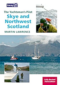
Skye and Northwest Scotland (The Yachtsman's Pilot, 3rd edition)
This Imray pilot covers the most remote areas of the west coast of Scotland between Ardnamurchan Point and Cape Wrath and the Island of Skye. Martin Lawrence has completely revised the text and for this edition has added new photographs taken from both the air and sea. The use of full colour throughout the work brings a clarity to the photographs and harbour plans. New photographs have been added to support changes to the text and plans in this 3rd edition.
Martin Lawrence has spent many years sailing on the West Coast of Scotland and is a Fellow of the Royal Institute of Navigation. He is well known as the author of the Yachtsman's Pilot series.
Szczegóły
Autor:
Martin Lawrence
Wydanie:
140 strony, 30 x 21.5 x 1.1 cm, miękka oprawa
Ilustracje:
bogato ilustrowane, kolorowych zdjęć i mapy
Wydawca:
Imray, Laurie, Norie & Wilson Ltd (GB, 2010)
ISBN:
9781846231780
Skye and Northwest Scotland (The Yachtsman's Pilot, 3rd edition)
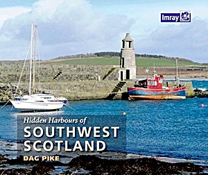
A a lively tour of small and infrequently visited harbours on the stunning Scottish coast and its nearby islands, starting from Port Logan in the south and meandering northwards to Lerags on Loch Feochan in the Firth of Lorn. The southwest coast of Scotland is one of the most beautiful cruising areas in the world, combining dramatic scenery with interesting history and landmarks. Many of its shores are lined with old castles and the magnificent historical houses of rich industrialists, reflecting its significance as an area of busy trade. The more recent military developments, which include a wartime torpedo base at Loch Long and the naval headquarters at Faslane on Gare Loch, also have a significant presence. Small harbours further south were shaped by the trade in natural resources and the flow of passengers via Clyde Puffer boats to and from nearby cities such as Glasgow and beyond.
Each hidden harbour, many of which are simple but attractive piers or shipways built to support trade, has a story to tell. The book includes a historical overview plus notes on what is to be found at each, alongside full colour photographs and annotated aerial shots. This edition complements the other Hidden Harbours titles in the series by Dag Pike.
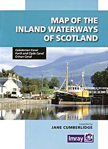
Map of the Inland Waterways of Scotland - Caledonian Canal, Forth & Clyde Canal, Crinan Canal
The second edition of Imray's Map of the Inland Waterways of Scotland has been updated. Contact details for the new Scottish Waterways body that replaces British Waterways have been added. The descriptive text has been improved with the addition of more photos.
Szczegóły
Autor:
Jane Cumberlidge
Wydanie:
1 strony, 22.5 x 15 x 1 cm, mapa (złożona)
Ilustracje:
bogato ilustrowane, kolorowych zdjęć i mapy
Wydawca:
Imray, Laurie, Norie & Wilson Ltd (GB, 2013)
ISBN:
9781846235221
Map of the Inland Waterways of Scotland - Caledonian Canal, Forth & Clyde Canal, Crinan Canal
Ta strona korzysta z plików cookie i podobnych technologii w celu poprawy komfortu korzystania z przeglądarki. Klikając "Zezwól", wyrażasz zgodę na korzystanie z tych technologii.
Kliknij "Odrzuć", aby wyłączyć nieistotne śledzenie. Dowiedz się więcej >