Przewodniki - Anglia - Wschodnie Wybrzeże: rzeki i kanały

Przewodnik żeglarski na rejs po Anglii (rzeki i kanały)? Znajdziesz tu przewodniki, które informują o nawigacji, portach jachtowych i atrakcjach turystycznych.

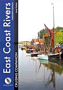
East Coast Rivers Cruising Companion - A Yachtsman's Pilot and Cruising Guide to the Waters from Lowestoft to Ramsgate

Well established as 'the East Coast yachtsman's bible', this 20th edition of Jan Harber's classic cruising companion marks the book's 60th anniversary. Dating back to 1956 when Jack Coote, Jan's father, produced the first black and white edition, "East Coast Rivers" now extending from Lowestoft to Ramsgate, continues to cover the rivers, curlew-haunted creeks and intricate shoals and swatchways of the Thames Estuary and surrounding rivers.

Comprehensive pilotage and nautical information based on years of local knowledge is complemented by port information and local maritime history, helping cruising sailors to make the most of their visit to the East Coast.
The text is illustrated throughout with updated charts and photographs, including spectacular aerial shots of a number of the rivers and entrances that make up this cherished cruising ground.
Not only a pilot guide, this is the memoir of a family's history; exploring, capturing and celebrating this extraordinary sailing area.

Szczegóły

Autor:Janet Harber
Wydanie:208 strony, 30.5 x 22 x 2 cm, twarda oprawa
Ilustracje:200+ kolorowych zdjęć, 45 mapy
Wydawca:Fernhurst Books (GB, 2016)
ISBN:9781909911512
East Coast Rivers Cruising Companion - A Yachtsman's Pilot and Cruising Guide to the Waters from Lowestoft to Ramsgate

East Coast Rivers Cruising Companion - A Yachtsman's Pilot and Cruising Guide to the Waters from Lowestoft to Ramsgate

Język: angielski

Kup na Amazon PL
Kup na Amazon DE

The River Great Ouse and its tributaries

Restructured to start at the head of navigation at Kempston, upstream of Bedford, this guide takes you downstream along the full length of the navigable River Great Ouse and then up its accessible river tributaries. It includes the Rivers Cam, Lark, Little Ouse and Wissey, Hundred Foot River, Relief Channel and the tidal Ouse to King's Lynn.
This sixth edition has been expanded to include an extra 60 miles of navigable waterways not previously detailed, including the tidal section to Kings Lynn and gems such as the Cambridge Backs World Heritage site.

Imray's popular inland waterways guides are being revised with experienced boat-owners and navigators from the Inland Waterways Association. This new guide has been written by Chris Howes, Deputy National Chairman, Eastern Region Chairman and past Peterborough Branch Chairman of the IWA.
Chris has spent much of his life living on or near the River Great Ouse and is a knowledgeable enthusiast for the area.
His navigation notes are the result of his most recent on-the-water research, enriched with supplementary narrative and photographs highlighting numerous points of interest.

With a completely new design and layout, information on moorings, facilities and services is enhanced with quick reference tables alongside the plans.
For anyone planning to explore these waterways, this is your invaluable, don't-leave-home-without-it guide.

Szczegóły

Autor:Chris Howes
Wydanie:264 strony, 24 x 17.5 x 2.2 cm, twarda oprawa
Ilustracje:bogato ilustrowane, kolorowych zdjęć i mapy
Wydawca:Imray, Laurie, Norie & Wilson Ltd (GB, 2021)
ISBN:9781786792464
The River Great Ouse and its tributaries

The River Great Ouse and its tributaries

Język: angielski

Kup na Amazon PL
Kup na Amazon DE

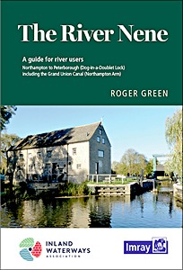
The River Nene - A guide for river users

With support from the Inland Waterways Association, Friends of the River Nene and others, and drawing on his longstanding connection with the river, Roger Green has thoroughly revised and updated this popular guide.
A new design includes thorough navigation notes alongside more detailed maps of the canal and river, showing the main features of the navigation.

Helpful tables indicate mileages and likely timings between locks to help with passage planning and also provide further information on all the moorings, facilities and services, many of which have been much improved in recent years. Other features of interest such as canoe launch access and portage points are also shown.
Details of facilities, walking and cycling routes and local history add useful information. Photographs help to highlight points of interest along the way and confirm this guide to be the essential companion for anyone planning to navigate the river, whether by boat, canoe, bicycle or on foot.

Covers the River Nene from Northampton to Peterborough (Dog-in-a-Doublet Lock) including the Grand Union Canal (Northampton Arm).

Szczegóły

Autor:Roger Green
Wydanie:24 x 17 x 1.3 cm, miękka oprawa
Ilustracje:bogato ilustrowane, kolorowych zdjęć i mapy
Wydawca:Imray, Laurie, Norie & Wilson Ltd (GB, 2020)
ISBN:9781786791634
The River Nene - A guide for river users

The River Nene - A guide for river users

Język: angielski

Kup na Amazon PL
Kup na Amazon DE

Inne książki z tej kategorii:

CCC Sailing Directions - Kintyre to Ardnamurchan

CCC Sailing Directions - Kintyre to Ardnamurchan

Clyde Cruising Club, Edward Mason | angielski | wiązanie spiralne | 104 str. | 2020

CCC Sailing Directions - Firth of Clyde

CCC Sailing Directions - Firth of Clyde - Including Solway Firth and North Channel

Clyde Cruising Club, Geoff Crowley | angielski | wiązanie spiralne | 150 str. | 2020

CCC Sailing Directions - Ardnamurchan to Cape Wrath

CCC Sailing Directions - Ardnamurchan to Cape Wrath

Clyde Cruising Club, Edward Mason | angielski | wiązanie spiralne | 104 str. | 2022

Skye & Northwest Scotland (The Yachtsman's Pilot)

Skye and Northwest Scotland (The Yachtsman's Pilot, 3rd edition)

Martin Lawrence | angielski | miękka oprawa | 140 str. | 2010

Hidden Harbours of Southwest Scotland

Hidden Harbours of Southwest Scotland

Dag Pike | angielski | miękka oprawa | 64 str. | 2015

Map of the Inland Waterways of Scotland

Map of the Inland Waterways of Scotland - Caledonian Canal, Forth & Clyde Canal, Crinan Canal

Jane Cumberlidge | angielski | mapa (złożona) | 1 str. | 2013


Najnowsza aktualizacja: 2024-12-19