Jeśli złożysz zamówienie za pomocą przycisków na tej stronie, możemy otrzymać niewielką prowizję bez dodatkowych kosztów dla Ciebie. Więcej informacji >

Przewodniki żeglarskie - Holandia: nawigacja i mariny

Przewodnik żeglarski na wakacje w Holandii? Znajdziesz tu przewodniki, które informują o nawigacji, portach jachtowych i atrakcjach turystycznych w Holandii.

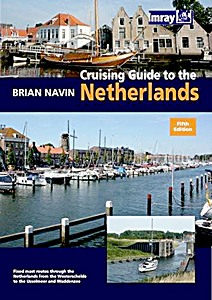
Cruising Guide to the Netherlands (5th edition)

This is the fifth editon of 'Cruising Guide to the Netherlands' which was first published in 1988. It is regarded as the authoritative companion for anyone cruising the Netherlands using fixed mast routes.

Brian Navin's guide is based on popular selected routes which offer an opportunity to visit most of the regions of the Netherlands from the estuary of the Schelde up to the IJsselmeer and Waddensee.

This new edition follows the same pattern, and includes corrections and updates that have accumulated since the fourth edition was published. This includes amended harbour plans and new photographs taken by the author.

Szczegóły

Autor:Brian Navin
Wydanie:203 strony, 29.5 x 21 x 1.5 cm, miękka oprawa
Ilustracje:bogato ilustrowane, kolorowych zdjęć i mapy
Wydawca:Imray, Laurie, Norie & Wilson Ltd (GB, 2010)
ISBN:9781846231858
Książka: Cruising Guide to the Netherlands (5th edition)

Cruising Guide to the Netherlands (5th edition)

Język: angielski

Kup na Amazon PL
Kup na Amazon DE

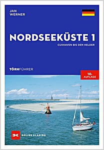
Törnführer Nordseeküste 1 - Cuxhaven bis Den Helder

NOWOŚĆ

Morze Północne to atrakcyjny, ale wymagający akwen żeglarski. Przewodnik Jana Wernera przedstawia najlepsze trasy żeglarskie między Cuxhaven a Den Helder. Wyjaśnia on specyfikę wód pływowych w Niemczech i Holandii, dzięki czemu nawet początkujący mogą bezpiecznie nawigować.
Opisywane rejony obejmują Helgoland, rzekę Weser, Jade i Jadebusen, Fryzyjskie Morze Wattowe, Ems wraz z Borkum, holenderskie Waddenzee oraz Wyspy Zachodniofryzyjskie. Zawarto wszystkie istotne informacje o portach, w tym podejścia, usługi, udogodnienia i atrakcje.

9. wydanie przedstawia także w przystępny sposób podstawy sztuki żeglarskiej i nawigacji w wodach pływowych. Zaktualizowane dane ułatwiają planowanie i orientację na miejscu.
Morze Północne oferuje zarówno doświadczonym, jak i początkującym żeglarzom zróżnicowane trasy, imponujące krajobrazy i wyzwania związane z pływami i zmienną pogodą. Z tą praktyczną książką pokładową jesteś dobrze przygotowany do bezpiecznej i spokojnej żeglugi.

Szczegóły

Autor:Jan Werner
Wydanie:272 strony, 24 x 17 x 1.7 cm, miękka oprawa
Ilustracje:128 kolorowych zdjęć, 100 mapy kolorowe
Wydawca:Delius Klasing Verlag GmbH (D, 2024)
ISBN:9783667121745
Książka: Törnführer Nordseeküste 1 - Cuxhaven bis Den Helder

Törnführer Nordseeküste 1 - Cuxhaven bis Den Helder

Język: niemiecki

Kup na Amazon PL
Kup na Amazon DE

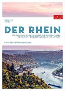
Der Rhein - Vom Rheinfall bis zur Nordsee und zum IJsselmeer. Neckar bis Heidelberg und Lahn bis Limburg

Od Górnego Renu po Holandię: Ren i jego dopływy oferują różnorodne możliwości dla miłośników rejsów. Niezależnie od tego, czy to weekendowa wycieczka wzdłuż winnic, czy dłuższa podróż do IJsselmeer, planowanie jest niezbędne.

9. wydanie sprawdzonego przewodnika wodnego Manfreda Fenzla zawiera wszystkie informacje potrzebne do spokojnego rejsu po Renie. Kompaktowy przewodnik obejmuje wszystkie odcinki Renu - od Wodospadów Renu w Schaffhausen po ujście do Morza Północnego - oraz jego dopływy: Górny Ren, Ren Górny, Ren Środkowy, Dolny Ren, Neckar do Heidelbergu, Lahn do Limburg, Gelderse IJssel i Moza.

Szczegółowe mapy z kilometrażem, śluzami, wysokościami mostów, stacjami paliw, slipami i miejscami postoju ułatwiają nawigację. Liczne zdjęcia i krótkie opisy każdego odcinka zapewniają dobrą orientację.
Dzięki temu przewodnikowi kapitanowie mają wszystkie informacje potrzebne do bezpiecznych i przyjemnych rejsów po Renie w jednym miejscu.

Szczegóły

Autor:Manfred Fenzl
Wydanie:208 strony, 30 x 21.5 x 2.2 cm, twarda oprawa
Ilustracje:140 mapy
Wydawca:Edition Maritim (D, 2022)
ISBN:9783667121608
Książka: Der Rhein - Vom Rheinfall bis zur Nordsee und zum IJsselmeer. Neckar bis Heidelberg und Lahn bis Limburg

Der Rhein - Vom Rheinfall bis zur Nordsee und zum IJsselmeer. Neckar bis Heidelberg und Lahn bis Limburg

Język: niemiecki

Kup na Amazon PL
Kup na Amazon DE

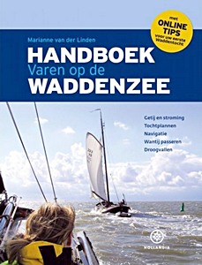
Handboek varen op de Waddenzee

The "Handboek varen op de Waddenzee" is one of the most successful Hollandia publications of recent years. The book has been enthusiastically received in the water sports world and has proven itself as a fully-fledged standard work.

This new edition has been completely updated and is up-to-date and will show both new and advanced sailors the way on the Wadden Sea. Sailing on the Wadden Sea remains a challenge for many water sports enthusiasts and this book offers the knowledge you need for this.

Special attention to:
- Tides and currents
- Trip plans
- Navigation
- Passing the Wantij
- Running aground.

Szczegóły

Autor:Marianne van der Linden
Wydanie:224 strony, 28 x 21.5 x 2 cm, twarda oprawa
Ilustracje:bogato ilustrowana
Wydawca:Gottmer Uitgevers Groep BV (NL, 2019)
ISBN:9789064106576
Książka: Handboek varen op de Waddenzee

Handboek varen op de Waddenzee

Język: niemiecki

Kup na Amazon PL
Kup na Amazon DE

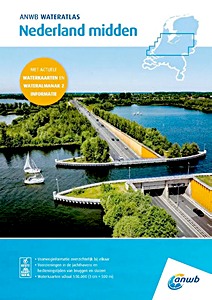
ANWB Wateratlas - Nederland Midden

NOWOŚĆ

"ANWB Wateratlas Nederland Midden" to niezbędne źródło informacji dla miłośników sportów wodnych. Ten atlas łączy znane mapy wodne ANWB oraz informacje z Wateralmanak część 2. Dzięki zintegrowanym mapom wodnym można łatwo nawigować po jeziorach i rzekach oraz szybko znaleźć informacje o marinach i godzinach otwarcia mostów i śluz.

Wateratlas Nederland Midden zawiera:
- Informacje o drogach wodnych
- Udogodnienia w marinach
- Godziny otwarcia mostów i śluz
- Mapy wodne (skala 1: 50.000, 1 cm = 500 m)

Szczegóły

Autor:ANWB
Wydanie:120 strony, 42 x 30.5 x 1.2 cm, miękka oprawa
Wydawca:ANWB (NL, 2025)
ISBN:9789018054076
Książka: ANWB Wateratlas - Nederland Midden

ANWB Wateratlas - Nederland Midden

Język: holenderski

Kup na Amazon PL
Kup na Amazon DE

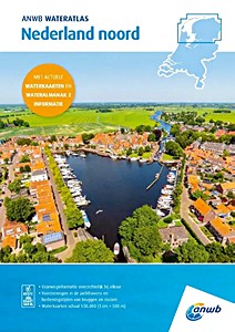
ANWB Wateratlas - Nederland Noord

NOWOŚĆ

ANWB Wateratlas Nederland Noord (Atlas Wodny ANWB - Północna Holandia) to kompaktowe i praktyczne źródło informacji dla żeglarzy. Łączy mapy wodne ANWB z danymi z Wateralmanak, część 2. Dzięki temu można łatwo nawigować po jeziorach i rzekach oraz szybko znaleźć informacje o marinach i godzinach otwarcia mostów i śluz.

Ten atlas wodny zawiera:
- Informacje o szlakach wodnych
- Udogodnienia w marinach
- Godziny otwarcia mostów i śluz
- Mapy wodne w skali 1: 50 000 (1 cm = 500 m)

Szczegóły

Autor:ANWB
Wydanie:120 strony, 42 x 30 x 1 cm, miękka oprawa
Wydawca:ANWB (NL, 2025)
ISBN:9789018054069
Książka: ANWB Wateratlas - Nederland Noord

ANWB Wateratlas - Nederland Noord

Język: holenderski

Kup na Amazon PL
Kup na Amazon DE

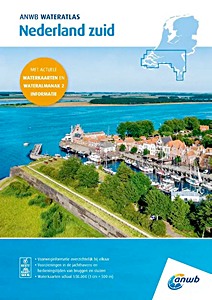
ANWB Wateratlas - Nederland Zuid

NOWOŚĆ

"ANWB Wateratlas Nederland Zuid" to kompaktowe i praktyczne źródło informacji dla żeglarzy. Łączy mapy wodne ANWB z danymi z "Wateralmanak, część 2". Dzięki temu można łatwo nawigować po jeziorach i rzekach oraz szybko znaleźć informacje o marinach i godzinach otwarcia mostów i śluz.

Ten atlas wodny zawiera:
- Informacje o szlakach wodnych
- Udogodnienia w marinach
- Godziny otwarcia mostów i śluz
- Mapy wodne w skali "1: 50 000" (1 cm = 500 m)

Szczegóły

Autor:ANWB
Wydanie:120 strony, 42 x 30.5 x 1 cm, miękka oprawa
Wydawca:ANWB (NL, 2025)
ISBN:9789018054083
Książka: ANWB Wateratlas - Nederland Zuid

ANWB Wateratlas - Nederland Zuid

Język: holenderski

Kup na Amazon PL
Kup na Amazon DE

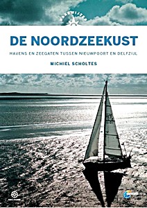
Vaarwijzer: De Noordzeekust

The coast of the Low Countries is one of the most dangerous in the world. There is hardly any place to shelter. Currents, breakers and swell can pose a great danger and there are sandbanks in inconvenient places. Michiel Scholtes travelled from Nieuwpoort to Delfzijl and wrote a practical reference work with which sailors can approach ports and sea inlets in the area in a responsible manner.
In this Vaarwijzer you can read not only about the dangers, but also about the great pleasure of a beautiful trip along the dune row. An indispensable book on board for anyone who ventures out to sea.

In 2020, Peter Schermer sailed the coastal area again in the wake of Michiel Scholtes. He carefully noted the changes in the approaches to a safe harbour and has incorporated them into this new edition.

Many thousands of water sports enthusiasts have experienced successful boat trips and holidays in recent years with the help of the practical Vaarwijzer guides. The series is compiled by experienced sailors in the relevant sailing area. The authors want to inspire readers and provide them with all the necessary information to be able to prepare a trip well.

Fourth, revised edition

Szczegóły

Autor:Michiel Scholtes
Wydanie:207 strony, 25 x 17.5 x 2 cm, twarda oprawa
Ilustracje:bogato ilustrowane, kolorowych zdjęć i mapy
Wydawca:Gottmer Uitgevers Groep BV (NL, 2021)
Seria:Hollandia Vaarwijzer
ISBN:9789064107207
Książka: Vaarwijzer: De Noordzeekust

Vaarwijzer: De Noordzeekust

Język: holenderski

Kup na Amazon PL
Kup na Amazon DE

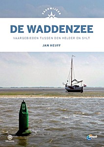
Vaarwijzer: De Waddenzee - Vaargebieden tussen Den Helder en Sylt

The "Vaarwijzer De Waddenzee" has been the reference work for all water sports enthusiasts who want to sail between Den Helder and Sylt for decades. This waterway, however beautiful, can be very changeable. Author Jan Hueff lives on Terschelling and keeps a close eye on the changes in channels, tidal flats and harbours on all his sailing trips.
This new edition is designed in the new house style of the Vaarwijzer series and has been completely updated and up-to-date.

Many thousands of water sports enthusiasts have experienced successful boat trips and holidays in recent years with the help of the practical Vaarwijzer guides. The series is compiled by experienced sailors in the relevant sailing area. The authors want to inspire readers and provide them with all the necessary information to be able to prepare a trip well.

Szczegóły

Autor:Jan Heuff
Wydanie:200 strony, 24.5 x 17.5 x 1.9 cm, twarda oprawa
Ilustracje:bogato ilustrowane, kolorowych zdjęć
Wydawca:Gottmer Uitgevers Groep BV (NL, 2021)
Seria:Hollandia Vaarwijzer
ISBN:9789064107191
Książka: Vaarwijzer: De Waddenzee - Vaargebieden tussen Den Helder en Sylt

Vaarwijzer: De Waddenzee - Vaargebieden tussen Den Helder en Sylt

Język: holenderski

Kup na Amazon PL
Kup na Amazon DE

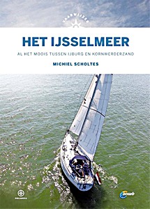
Vaarwijzer: Het IJsselmeer - Al het moois tussen IJburg en Kornwederzand

For many sailors, the IJsselmeer is the first major waterway from the lakes. However, most water sports enthusiasts only sail along the main harbours, while there is so much beauty to be found off the beaten track.
In addition to all the information about the well-known harbours and routes, this Vaarwijzer also tries to tempt the reader to discover lesser-known places. This new edition is completely up-to-date again, including the new sailing area around the Marker Wadden, so that everyone can enjoy themselves on their own water this summer.

Many thousands of water sports enthusiasts have experienced successful boat trips and holidays in recent years with the help of the practical Vaarwijzer guides. The series is compiled by experienced sailors in the relevant sailing area. The authors want to inspire readers and provide them with all the necessary information to be able to prepare a trip well.

Szczegóły

Autor:Michiel Scholtes
Wydanie:159 strony, 25 x 17.5 x 1.4 cm, twarda oprawa
Ilustracje:bogato ilustrowane, kolorowych zdjęć i mapy
Wydawca:Gottmer Uitgevers Groep BV (NL, 2021)
Seria:Hollandia Vaarwijzer
ISBN:9789064107412
Książka: Vaarwijzer: Het IJsselmeer - Al het moois tussen IJburg en Kornwederzand

Vaarwijzer: Het IJsselmeer - Al het moois tussen IJburg en Kornwederzand

Język: holenderski

Kup na Amazon PL
Kup na Amazon DE

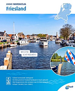
ANWB Wateratlas - Friesland

Mapy i atlasy wodne ANWB to niezbędne narzędzie w żegludze. Żaden kapitan w Holandii nie wypływa bez tych wiarygodnych informacji nawigacyjnych. Ten atlas wodny jest szczególnie przydatny podczas żeglugi we Fryzji i zawiera:

- Szczegółowe i dokładne mapy nawigacyjne
- Numery mostów powiązane z Wateralmanak 2
- Spis marin
- Informacje o dopuszczalnych głębokościach żeglugowych
- Maksymalne prędkości na poszczególnych trasach
- Mapy szczegółowe ważniejszych miejscowości
- Czytelną legendę

Szczegóły

Autor:ANWB
Wydanie:33 strony, 30 x 24.5 x 0.5 cm, miękka oprawa
Wydawca:ANWB (NL, 2020)
ISBN:9789018045951
Książka: ANWB Wateratlas - Friesland

ANWB Wateratlas - Friesland

Język: holenderski

Kup na Amazon PL
Kup na Amazon DE

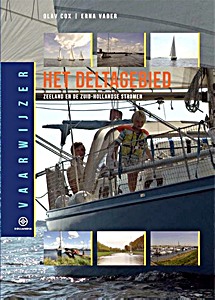
Vaarwijzer: Het Deltagebied - Zeeland en de Zuid-Hollandse stromen

Tussen Dordrecht en Zeeuws-Vlaanderen ligt een vaargebied van ongekende variatie. Voor veel watersporters is de Delta het eerste gebied waar ze geconfronteerd worden met echt stromend water.
Voor wie voorzichtig wil beginnen zijn er de afgesloten zeearmen, zoals de Grevelingen en het Veerse Meer. Maar voor iedereen die de eerste stappen van het zeilen op groot water goed doorstaan heeft, vormen natuurlijk de Oosterschelde en de Westerschelde, met hun getijden en grote oppervlakten aan open water, het echte werk.
En voor wie nog verder wil, ligt voor de Zeeuwse kust een uitdagend deel van de Noordzee te wachten.

Olav Cox zeilde met zijn gezin rond de wereld en schreef hierover het reisverhaal "Ritme van de oceaan". Voor het samenstellen van deze Vaarwijzer keerde hij terug naar zijn thuiswateren.
De serie Hollandia Vaarwijzers wordt samengesteld door routiniers in het betreffende vaargebied. De auteurs willen lezers inspireren en hun daarbij alle noodzakelijk informatie verschaffen om een tocht goed te kunnen voorbereiden.

Szczegóły

Autor:Olav Cox - Erna Vader
Wydanie:192 strony, 24.5 x 17.5 x 1.7 cm, twarda oprawa
Ilustracje:bogato ilustrowane, kolorowych zdjęć
Wydawca:Gottmer Uitgevers Groep BV (NL, 2018)
Seria:Hollandia Vaarwijzer
ISBN:9789064106460
Książka: Vaarwijzer: Het Deltagebied - Zeeland en de Zuid-Hollandse stromen

Vaarwijzer: Het Deltagebied - Zeeland en de Zuid-Hollandse stromen

Język: holenderski

Kup na Amazon PL
Kup na Amazon DE
< >

Inne książki z tej kategorii:

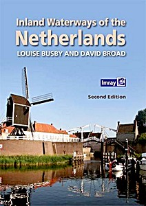
Inland Waterways of the Netherlands

Inland Waterways of the Netherlands (2nd Edition)

Louise Busby, David Broad | angielski | twarda oprawa | 300 str. | 2016

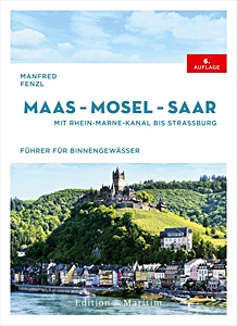
Maas - Mosel - Saar

NOWOŚĆ

Maas - Mosel - Saar - Mit Rhein-Marne-Kanal bis Straßburg

Manfred Fenzl | niemiecki | twarda oprawa | 272 str. | 2025

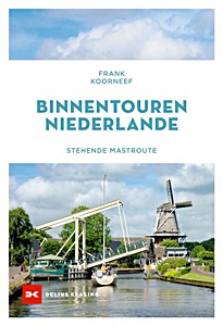
Binnentouren Niederlande - Stehende Mastroute

NOWOŚĆ

Binnentouren Niederlande - Stehende Mastroute

Frank Koorneef | niemiecki | miękka oprawa | 176 str. | 2024

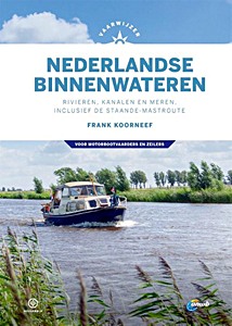
Vaarwijzer Nederlandse binnenwateren

Vaarwijzer Nederlandse binnenwateren - Rivieren, kanalen en meren, inclusief de staande-mastroute

Frank Koorneef | holenderski | twarda oprawa | 296 str. | 2020

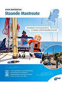
ANWB Wateratlas - Staande Mastroute

NOWOŚĆ

ANWB Wateratlas - Staande Mastroute

ANWB | holenderski | miękka oprawa | 61 str. | 2024

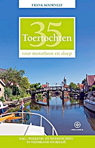
35 Toertochten voor motorboot en sloep

35 Toertochten voor motorboot en sloep - Dag-, weekend- en weektochten in Nederland en België

Frank Koorneef | holenderski | miękka oprawa | 352 str. | 2019

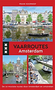
Vaarroutes Amsterdam

Vaarroutes Amsterdam - De 10 mooiste routes door Amsterdam en omstreken

Frank Koorneef | holenderski | miękka oprawa | 127 str. | 2017

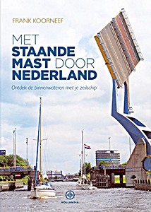
Met staande mast door Nederland

Met staande mast door Nederland - Ontdek de binnenwateren met je zeilschip

Frank Koorneef | holenderski | miękka oprawa | 144 str. | 2016