Acquistando tramite i link, sostieni nostro sito senza alcun costo aggiuntivo per te. Per saperne di più >

Guide nautiche - Inghilterra: fiumi e canali

Esplora le migliori guide per vacanze in barca in Inghilterra (fiumi e canali). Scopri Imray, Adlard Coles e altre guide nautiche con informazioni su navigazione, porti turistici e attrazioni turistiche.

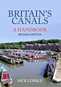
Britain's Canals- A Handbook (Revised Edition)

With over 2,000 miles of navigable waterway in the UK, Britain's canals are an asset to be treasured by everyone. Nick Corble has written an accessible guide which will help you get the best out of a visit or a boating holiday on the canal network.

Whether your interest lies in the history, the flora and fauna to be found along the towpath, or even the types of boats and their decoration, there is enough in "Britain's Canals: A Handbook" to inform and entertain you.
Seeking to appeal to and aid the interested tourist, dog-walker, passer-by, or even hopeful boat-buyer, this handbook is packed with tips, hints and useful facts, presented in layman's terms and helping the reader discover what makes our canals so special.
A wealth of illustrations in full colour makes this the perfect primer for anyone who wants to know more about Britain's waterways.

Nick Corble writes extensively on canals and there is little he does not know about the network of waterways that criss-cross Britain. This is his seventh book on canals and canal history.

Dettagli del libro

Autore:Nick Corble
Formato:96 pagine, 23.5 x 16.5 cm, brossura
Illustrazioni:150 foto in colori
Lingua:inglese
Editore:Amberley Publishing (GB, 2016)
ISBN:9781445658131
Copertina del libro: Britain's Canals- A Handbook (Revised Edition) | Amberley

Britain's Canals- A Handbook (Revised Edition)

Lingua: inglese

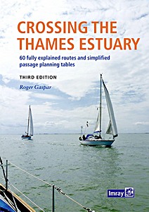
Crossing the Thames Estuary - 60 fully explained routes and simplified passage planning tables

The Thames Estuary is a complex and challenging area with narrow channels, shoal waters, determined tides and shifting sands, plus busy shipping traffic, three major ports and six wind farms in and around it. But its waters are also fascinating, interesting and have a wide selection of destinations to enjoy.
This book describes 60 safe, viable and feasible routes between the Kent, Essex and Suffolk rivers for safe passage and wholly new time-planning tables which are now simplified with significantly additional and readily available information.

The third edition retains all the popular features describing and illustrating each sector of each route, with waypoints and 'rolling road' diagrams, providing information and advice about potential or permanent hazards, the implications for the tide and guidance about shipping routes and anchorages.

Included are new and unique passage planning tables which are simple, accurate and quick to use. Readers can select the most appropriate start time and will instantly see predicted arrival time so as to have sufficient time to continue up river to an ultimate destination.
Options are offered for every 30 minutes of the day, whatever the day. The tables not only provide the best predicted start time - for the quickest passage duration - for each route at 4, 5, 6 or 7 knots boat speed, but display alternative passage durations, whatever the tide.

Tables provide easier access and a much broader basis of information than in earlier editions, presented alongside more detailed chartlets and a new portrait format book.
Sailors benefit from swatchways in the Estuary which shorten time and distance for many passages. However, as they're liable to move or change as sands shift, the author endeavours to survey several critical swatchways, monitors and provides illustrated Notices to Mariners weekly and receives reports from readers. Any significant changes or downloads are reported by updates on the website or by email to readers on the 'Readers' Update' list.

Dettagli del libro

Autore:Roger Gaspar
Formato:268 pagine, 30 x 22.5 x 2 cm, rilegatura a spirale
Illustrazioni:riccamente illustrato con foto in colori e mappe
Lingua:inglese
Editore:Imray, Laurie, Norie & Wilson Ltd (GB, 2022)
ISBN:9781786793195
Copertina del libro: Crossing the Thames Estuary - 60 fully explained routes and simplified passage planning tables | Imray

Crossing the Thames Estuary - 60 fully explained routes and simplified passage planning tables

Lingua: inglese

East Coast Rivers Cruising Companion - A Yachtsman's Pilot and Cruising Guide to the Waters from Lowestoft to Ramsgate

Well established as 'the East Coast yachtsman's bible', this 20th edition of Jan Harber's classic cruising companion marks the book's 60th anniversary. Dating back to 1956 when Jack Coote, Jan's father, produced the first black and white edition, "East Coast Rivers" now extending from Lowestoft to Ramsgate, continues to cover the rivers, curlew-haunted creeks and intricate shoals and swatchways of the Thames Estuary and surrounding rivers.

Comprehensive pilotage and nautical information based on years of local knowledge is complemented by port information and local maritime history, helping cruising sailors to make the most of their visit to the East Coast.
The text is illustrated throughout with updated charts and photographs, including spectacular aerial shots of a number of the rivers and entrances that make up this cherished cruising ground.
Not only a pilot guide, this is the memoir of a family's history; exploring, capturing and celebrating this extraordinary sailing area.

Dettagli del libro

Autore:Janet Harber
Formato:208 pagine, 30.5 x 22 x 2 cm, copertina rigida
Illustrazioni:200+ foto in colori, 45 mappe
Lingua:inglese
Editore:Fernhurst Books (GB, 2016)
ISBN:9781909911512
Copertina del libro: East Coast Rivers Cruising Companion - A Yachtsman's Pilot and Cruising Guide to the Waters from Lowestoft to Ramsgate | Fernhurst

East Coast Rivers Cruising Companion - A Yachtsman's Pilot and Cruising Guide to the Waters from Lowestoft to Ramsgate

Lingua: inglese

Inland Waterways of Great Britain (8th edition)

The standard reference to the waterways of England, Wales and Scotland has been completely revised. The 8th edition retains the format of previous editions but, throughout, details are updated and the work has been widened in its scope to appeal not only to navigators but to all users of the waterways.
Full colour throughout.

Dettagli del libro

Autore:Jane Cumberlidge
Formato:300 pagine, 30.5 x 21.5 x 5.4 cm, copertina rigida
Illustrazioni:riccamente illustrato con foto in colori e mappe
Lingua:inglese
Editore:Imray, Laurie, Norie & Wilson Ltd (GB, 2009)
ISBN:9781846230103
Copertina del libro: Inland Waterways of Great Britain (8th edition) | Imray

Inland Waterways of Great Britain (8th edition)

Lingua: inglese

Inshore Britain

An invaluable resource when planning a journey by small boat anywhere along Britain's coast. Designed to provide guidance for sea kayakers, it is also appropriate for those making day trips in small craft.

Full of sound and practical advice, providing essential guidance on aspects of safety and incorporating an exhaustive directory of useful information, this is the most comprehensive guide to Britain's inshore waters available in a single volume.

'Inshore Britain' is an anthology of articles, each dealing with a particular stretch of coast around Britain, that were first published in Canoeist magazine. Stuart Fisher's commentary is a fascinating read for anyone interested in Britain's long and varied coastline. The text is fully illustrated with full colour mapping and the author's photography.

Dettagli del libro

Autore:Stuart Fisher
Formato:366 pagine, 29.5 x 21.5 x 2.1 cm, brossura
Illustrazioni:riccamente illustrato con foto in colori e mappe
Lingua:inglese
Editore:Imray, Laurie, Norie & Wilson Ltd (GB, 2006)
ISBN:9780852889060
Copertina del libro: Inshore Britain | Imray

Inshore Britain

Lingua: inglese

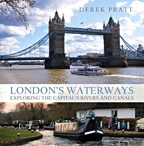
London's Waterways

London boasts not only one of the most famous and awe-inspiring rivers of the world, but is also home to beautiful and majestic canals such as the Grand Union and Regents Canal - ever popular with tourists and increasingly sought-after by waterside residents.
Tucked away in the city are also lesser-known (and in some cases completely hidden) waterways, which this book magically opens up for the reader. Rivers flow through shopping centres and across tube platforms as well as creating surprisingly rural settings within the capital.

This visually stunning and often unexpected look at the iconic landscapes, beautiful scenery and secret places all around London's waterways is the first book of its kind. By the same author as the popular Waterways Past and Present and The Thames: A Photographic Journey from Source to Sea, this book teems with fabulous photography and fascinating information, giving readers a unique insight into both well-loved and relatively unexplored aspects of London.
With its stylish design, beautiful photography and quirky captions, this gorgeous coffee table book is the perfect gift for inland waterways enthusiasts, as well as tourists and Londoners.

Dettagli del libro

Autore:Derek Pratt
Formato:160 pagine, 26 x 25.5 x 1.9 cm, copertina rigida
Illustrazioni:riccamente illustrato con foto in colori
Lingua:inglese
Editore:Bloomsbury Publishing PLC (GB, 2010)
ISBN:9781408110744
Copertina del libro: London's Waterways | Bloomsbury PLC

London's Waterways

Lingua: inglese

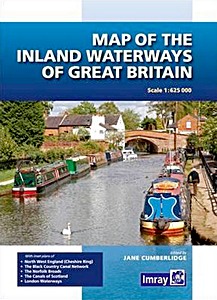
Map of the Inland Waterways of Great Britain

First published over 60 years ago when interest in reviving Britain's network of navigable and rivers was starting to gather pace, this map provides the best coverage of the system in England, Wales and Scotland.
Distances, the number of locks and restricting dimensions are given for each waterway. The simple cartography defines rivers, broad and narrow canals against generalized relief and the major road network.
The 2016 edition has been updated to show progress in restoration schemes and other changes.

Dettagli del libro

Autore:Jane Cumberlidge
Formato:1 pagine, 26 x 19 x 1.2 cm, copertina rigida
Illustrazioni:riccamente illustrato con foto in colori e mappe
Lingua:inglese
Editore:Imray, Laurie, Norie & Wilson Ltd (GB, 2016)
ISBN:9781846238277
Copertina del libro: Map of the Inland Waterways of Great Britain | Imray

Map of the Inland Waterways of Great Britain

Lingua: inglese

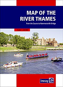
Map of the River Thames - From the Source to Hammersmith Bridge

This popular map of the non-tidal Thames from its the source above Cricklade to the entrance of the Grand Union Canal at Brentford below Teddington Locks is convenient in any cockpit and is the ideal companion to Chris Cove-Smith's River Thames Book.

Full information on boating facilities is included in the mapping, as are all the essential details on restricting dimensions, locks and bridges. Also shown are pubs, the Thames Path and other features of special interest.
Large-scale insets of Oxford, Abingdon, Reading, Henley, Windsor and Eton, the River Wey junction and the entrance to the Grand Union Canal add to the clarity of this well presented map.

Dettagli del libro

Formato:1 pagine, 25 x 17.5 x 2.4 cm, mappa (piegata)
Illustrazioni:riccamente illustrato con foto in colori e mappe
Lingua:inglese
Editore:Imray, Laurie, Norie & Wilson Ltd (GB, 2021)
ISBN:9781786792532
Copertina del libro: Map of the River Thames - From the Source to Hammersmith Bridge | Imray

Map of the River Thames - From the Source to Hammersmith Bridge

Lingua: inglese

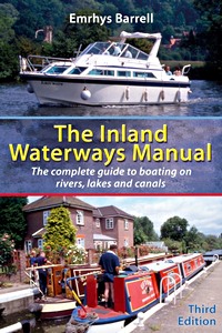
The Inland Waterways Manual - The complete guide to boating on rivers, lakes and canals (3rd Edition)

There are more than 4000 miles of navigable waterways in Great Britain, with more in Ireland and Europe. Peaceful canals, bustling rivers, glorious lakes - there is something for everyone.

This book will tell the reader all they need to know about how to get afloat - which boat to choose, whether to hire or buy, how much it will cost, and where they can go. Boat handling and manoeuvring are covered in detail, along with maintenance and repair. And there is a section on trailer boating for those who want to keep their boat at home, advice on living aboard for long periods, night-time navigation and training.

Dettagli del libro

Autore:Emrhys Barrell
Formato:224 pagine, 23.5 x 15.5 x 1.2 cm, brossura
Illustrazioni:riccamente illustrato con foto in colori e disegni
Lingua:inglese
Editore:Bloomsbury Publishing PLC (GB, 2006)
ISBN:9780713676365
Copertina del libro: The Inland Waterways Manual - The complete guide to boating on rivers, lakes and canals (3rd Edition) | Bloomsbury PLC

The Inland Waterways Manual - The complete guide to boating on rivers, lakes and canals (3rd Edition)

Lingua: inglese

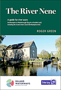
The River Nene - A guide for river users

With support from the Inland Waterways Association, Friends of the River Nene and others, and drawing on his longstanding connection with the river, Roger Green has thoroughly revised and updated this popular guide.
A new design includes thorough navigation notes alongside more detailed maps of the canal and river, showing the main features of the navigation.

Helpful tables indicate mileages and likely timings between locks to help with passage planning and also provide further information on all the moorings, facilities and services, many of which have been much improved in recent years. Other features of interest such as canoe launch access and portage points are also shown.
Details of facilities, walking and cycling routes and local history add useful information. Photographs help to highlight points of interest along the way and confirm this guide to be the essential companion for anyone planning to navigate the river, whether by boat, canoe, bicycle or on foot.

Covers the River Nene from Northampton to Peterborough (Dog-in-a-Doublet Lock) including the Grand Union Canal (Northampton Arm).

Dettagli del libro

Autore:Roger Green
Formato:24 x 17 x 1.3 cm, brossura
Illustrazioni:riccamente illustrato con foto in colori e mappe
Lingua:inglese
Editore:Imray, Laurie, Norie & Wilson Ltd (GB, 2020)
ISBN:9781786791634
Copertina del libro: The River Nene - A guide for river users | Imray

The River Nene - A guide for river users

Lingua: inglese

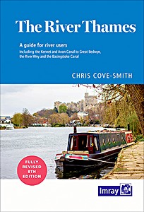
The River Thames - A guide for river users

The River Thames Book, now in its 8th edition, is the best-selling guide to the non-tidal Thames from Teddington to its source in Gloucestershire. This complete guide covers the Barrier to Cricklade with the River Wey, Basingstoke Canal and the Kennet & Avon Canal to Great Bedwyn.

Chris Cove-Smith's updated text describes the navigation with support of clear and detailed mapping. The River Thames Book also lists in exhaustive detail the facilities to be found along each section of the navigation.

Dettagli del libro

Autore:Chris Cove-Smith
Formato:235 pagine, 23.5 x 16.5 x 1.9 cm, rilegatura a spirale
Illustrazioni:riccamente illustrato con foto in colori e mappe
Lingua:inglese
Editore:Imray, Laurie, Norie & Wilson Ltd (GB, 2022)
ISBN:9781786791849
Copertina del libro: The River Thames - A guide for river users | Imray

The River Thames - A guide for river users

Lingua: inglese

The Thames - A Photographic Journey from Source to Sea

The Thames is unique, emerging as a small stream in idyllic countryside and growing into the country's largest river, passing through some of the world's most iconic urban environments. Linking London to the countryside and the sea, the Thames is the heart of the capital and its waters the lifeblood of England.

This beautiful book celebrates the entire river from source to sea, and with wonderful photography and quirky text follows it on a voyage through Britain's history. London has so often been the beginning and the end of the Thames story, and whilst it forms a major part, this book gives an altogether more complete and unexpected view of one of the most remarkable and well-loved rivers in the world.
We see the famous views and also learn lesser-known facts, such as Dick Turpin's secret hideaway (complete with an underground stable for Black Bess), the home of the notorious Chancellor Sir Francis Dashwood (the only Chancellor to have delivered his budget speech drunk) and the scene of the Monty Python fish-slapping dance.
First published in 2007, this gorgeous coffee table book has been updated for its second edition with new text and photography (including the Jubilee pageant), and continues to be the perfect gift for anyone living near, visiting or enjoying this magnificent river, with its visual variety, hidden secrets and fascinating history.

Dettagli del libro

Autore:Derek Pratt
Formato:160 pagine, 26 x 26 x 2 cm, copertina rigida
Illustrazioni:riccamente illustrato con foto in colori
Lingua:inglese
Editore:Bloomsbury Publishing PLC (GB, 2013)
ISBN:9781408186930
Copertina del libro: The Thames - A Photographic Journey from Source to Sea | Bloomsbury PLC

The Thames - A Photographic Journey from Source to Sea

Lingua: inglese

Titoli correlati:

Copertina del libro: The Scottish Islands: The Bestselling Guide to Every Scottish Island

The Scottish Islands: The Bestselling Guide to Every Scottish Island

Hamish Haswell-Smith | inglese | copertina rigida | 532 p. | 2015

Copertina del libro: CCC Sailing Directions - Ardnamurchan to Cape Wrath

CCC Sailing Directions - Ardnamurchan to Cape Wrath

Clyde Cruising Club, Edward Mason | inglese | rilegatura a spirale | 104 p. | 2022

Copertina del libro: Hidden Harbours of Southwest Scotland

Hidden Harbours of Southwest Scotland

Dag Pike | inglese | brossura | 64 p. | 2015

Copertina del libro: Shetland Islands Pilot

Shetland Islands Pilot

Gordon Garman | inglese | brossura | 150 p. | 2007

Copertina del libro: Skye and Northwest Scotland (The Yachtsman's Pilot, 3rd edition)

Skye and Northwest Scotland (The Yachtsman's Pilot, 3rd edition)

Martin Lawrence | inglese | brossura | 140 p. | 2010