Acquistando tramite i link, sostieni nostro sito senza alcun costo aggiuntivo per te. Per saperne di più >

Guide nautiche - Paesi Bassi: fiumi e canali

Una guida nautica per la tua crociera sui fiumi, canali e laghi dei Paesi Bassi? Qui trovi Imray, Adlard Coles e altre guide di navigazione che forniscono informazioni su rotte, porti turistici e attrazioni turistiche.

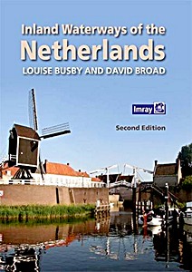
Inland Waterways of the Netherlands (2nd Edition)

With 6,000km of navigable waterways, the Netherlands offers one of the most extensive yet compact cruising grounds in Europe. This book is a user's guide to the whole network, covering all the mast-up routes and excluding only those waterways which offer less than 3.5m bridge height.
Navigational details are provided for each waterway, comprising dimensions and obstacles to be expected, including service arrangements for bridges and locks.
This is followed by details of over 300 stopping places across all 12 provinces- some which are large or popular harbours, and others which are well off the beaten track.

Comments on the significant features are expanded for nearly 100 'principal venues' where more details on things to do and see are provided, as well as information on practical facilities ashore and the authors' selective and subjective restaurant tips!
The book is designed to be of interest to all crew members, not just the skipper or navigator, whether its to establish how to approach a place, or to discover what to do or see of interest on arrival. Easy to browse, the book's illustrations have been selected to give a flavour of this water-loving country as well as to prepare the visiting yachtsman, whether under power or sail.

This second edition has been updated with amendments to the text and maps. There are also many new photos by the authors.

Dettagli del libro

Autore:Louise Busby, David Broad
Formato:300 pagine, 29.5 x 21 x 1.8 cm, copertina rigida
Illustrazioni:riccamente illustrato con foto in colori e mappe
Lingua:inglese
Editore:Imray, Laurie, Norie & Wilson Ltd (GB, 2016)
ISBN:9781846237485
Copertina del libro: Inland Waterways of the Netherlands (2nd Edition) | Imray

Inland Waterways of the Netherlands (2nd Edition)

Lingua: inglese

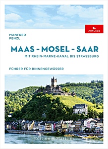
Maas - Mosel - Saar - Mit Rhein-Marne-Kanal bis Straßburg

NUOVO

Scoprite le vie navigabili della Mosa, della Mosella e della Saar - fiumi che attraversano Germania, Francia, Belgio, Lussemburgo e Paesi Bassi. Collegano villaggi vinicoli romantici, castelli medievali e paesaggi impressionanti. La guida fluviale di Manfred Fenzl è il compagno ideale per esplorare queste acque interne.
La sesta edizione rivista fornisce tutte le informazioni nautiche essenziali per una navigazione sicura e piacevole. Gli itinerari coprono la valle della Mosella, della Saar, della Mosa e il canale della Marna al Reno.

Comprende:
- Ponti, chiuse, livelli dell'acqua, soste e punti di rifornimento
- Informazioni legali per la nautica da diporto e canali VHF
- Consigli per imbarcazioni trasportate su rimorchio, con varo e campeggi

Con 150 illustrazioni e 135 carte a colori, la navigazione diventa semplice. Dalla Mosella tra Nancy e Coblenza, alla Mosa e al suo canale, o al circuito della Saar - questa guida garantisce crociere fluide e sicure. Una guida indispensabile per pianificare e vivere viaggi indimenticabili sulle acque interne d'Europa.

Dettagli del libro

Autore:Manfred Fenzl
Formato:272 pagine, 24.5 x 18 x 2.5 cm, copertina rigida
Illustrazioni:150 foto in colori, 135 mappe in colori
Lingua:tedesco
Editore:Edition Maritim (D, 2025)
ISBN:9783667122728
Copertina del libro: Maas - Mosel - Saar - Mit Rhein-Marne-Kanal bis Straßburg | Edition Maritim

Maas - Mosel - Saar - Mit Rhein-Marne-Kanal bis Straßburg

Lingua: tedesco

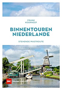
Binnentouren Niederlande - Stehende Mastroute

La rotta dell'albero fisso nei Paesi Bassi offre alle imbarcazioni a vela un modo unico per esplorare le vie navigabili interne del paese senza dover ammainare l'albero. Rappresenta un'alternativa tranquilla al spesso agitato Mare del Nord e permette di ammirare i paesaggi e la cultura olandesi da una prospettiva diversa.

Questa guida di navigazione copre l'intero percorso, inclusi l'accesso a laghi, canali e fiumi, consentendo un viaggio rilassante attraverso i Paesi Bassi con soste in città come Groningen, Makkum e Rotterdam. Unisce la tranquillità della navigazione a opportunità di visite culturali.

Il libro include informazioni essenziali per la pianificazione del viaggio, come l'apertura dei ponti, le chiuse, i porti, i limiti di profondità e le opzioni di ormeggio. È pensato per aiutare gli skipper a pianificare traversate sicure e piacevoli lungo l'intero percorso.

Scritto da Frank Koorneff, giornalista, fotografo e autore residente nei Paesi Bassi.

Dettagli del libro

Autore:Frank Koorneef
Formato:176 pagine, 24 x 16.5 x 1.6 cm, brossura
Illustrazioni:riccamente illustrato
Lingua:tedesco
Editore:Delius Klasing Verlag GmbH (D, 2024)
ISBN:9783667128324
Copertina del libro: Binnentouren Niederlande - Stehende Mastroute | Delius Klasing

Binnentouren Niederlande - Stehende Mastroute

Lingua: tedesco

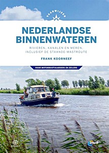
Vaarwijzer Nederlandse binnenwateren - Rivieren, kanalen en meren, inclusief de staande-mastroute

This is the reference work for all water sports enthusiasts who want to discover the Netherlands. The Dutch inland waters are unique: nowhere else in the world will you find such a fine-meshed and varied network, where you can visit all provinces while sailing.
Author Frank Koorneef provides sailing instructions, sailing routes, tips for preparing a trip and practical information about the well-known and lesser-known waterways of the Netherlands.
This new edition is designed in the new house style of the Vaarwijzer series and has been completely updated and brought up-to-date.

Many thousands of water sports enthusiasts have experienced successful boat trips and holidays in recent years with the help of the practical Vaarwijzer guides. The series is compiled by experienced sailors in the relevant sailing area. The authors want to inspire readers and provide them with all the necessary information to be able to prepare a trip well.

Dettagli del libro

Autore:Frank Koorneef
Formato:296 pagine, 24.5 x 17.5 x 2.3 cm, copertina rigida
Illustrazioni:riccamente illustrato con foto in colori e mappe
Lingua:olandese
Editore:Gottmer Uitgevers Groep BV (NL, 2020)
Collana:Hollandia Vaarwijzer
ISBN:9789064107214
Copertina del libro: Vaarwijzer Nederlandse binnenwateren - Rivieren, kanalen en meren, inclusief de staande-mastroute | Hollandia Vaarwijzer | Gottmer

Vaarwijzer Nederlandse binnenwateren - Rivieren, kanalen en meren, inclusief de staande-mastroute

Lingua: olandese

Titoli correlati:

Copertina del libro: ANWB Wateratlas - Nederland Midden

NUOVO

ANWB Wateratlas - Nederland Midden

ANWB | olandese | brossura | 120 p. | 2025

Copertina del libro: ANWB Wateratlas - Nederland Noord

NUOVO

ANWB Wateratlas - Nederland Noord

ANWB | olandese | brossura | 120 p. | 2025

Copertina del libro: ANWB Wateratlas - Nederland Zuid

NUOVO

ANWB Wateratlas - Nederland Zuid

ANWB | olandese | brossura | 120 p. | 2025

Copertina del libro: Törnführer Holland 1: Zeeland und die südlichen Provinzen

NUOVO

Törnführer Holland 1: Zeeland und die südlichen Provinzen

Jan Werner | tedesco | brossura | 224 p. | 2025

Copertina del libro: Törnführer Nordseeküste 1 - Cuxhaven bis Den Helder

Törnführer Nordseeküste 1 - Cuxhaven bis Den Helder

Jan Werner | tedesco | brossura | 272 p. | 2024

Copertina del libro: Friesland: Zwischen Ems, IJsselmeer, Waddenzee und IJssel. Mit Twenterevier und Route durch das Veen

Friesland: Zwischen Ems, IJsselmeer, Waddenzee und IJssel. Mit Twenterevier und Route durch das Veen

Manfred Fenzl, Anna Bunde | tedesco | copertina rigida | 232 p. | 2023

Copertina del libro: Vaarwijzer: De Waddenzee - Vaargebieden tussen Den Helder en Sylt | Hollandia Vaarwijzer

Vaarwijzer: De Waddenzee - Vaargebieden tussen Den Helder en Sylt

Jan Heuff | olandese | copertina rigida | 200 p. | 2021