Acquistando tramite i link, sostieni nostro sito senza alcun costo aggiuntivo per te. Per saperne di più >

Guide nautiche - Scozia: navigazione e porti

Esplora le migliori guide per le vacanze in crociera in Scozia. Scopri Imray, Adlard Coles e altre guide di navigazione che forniscono informazioni sulla navigazione, i porti turistici e le attrazioni turistiche in Scozia.

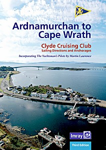
CCC Sailing Directions - Ardnamurchan to Cape Wrath

The area covered by this cruising guide includes the northern section of the West Coast of Scotland from Ardnamurchan Point to Cape Wrath, including the whole of Skye and the Small Isles.
The intricate and stunning coastline of lochs and islands offers a rich and varied cruising ground with a multitude of anchorages, many beneath a dramatic backdrop of munros.

This third edition, updated by Edward Mason, includes revised text and a selection of new photographs. Details on plans have been updated and include information from Bob Bradfield's Antares large scale charts. This well-respected title is an essential companion for anyone cruising these waters.

Dettagli

Autore:Clyde Cruising Club, Edward Mason
Formato:104 pagine, 29.5 x 23 x 2 cm, rilegatura a spirale
Illustrazioni:riccamente illustrato con foto in colori e mappe
Lingua:inglese
Editore:Imray, Laurie, Norie & Wilson Ltd (GB, 2022)
ISBN:9781786793232
Copertina del libro: CCC Sailing Directions - Ardnamurchan to Cape Wrath | Imray

CCC Sailing Directions - Ardnamurchan to Cape Wrath

Lingua: inglese

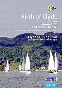
CCC Sailing Directions - Firth of Clyde - Including Solway Firth and North Channel

Part of the Clyde Cruising Club's Sailing Directions and Anchorages series, Firth of Clyde extends beyond its titled area to the coast of Northern Ireland (Rathlin Island to Belfast Lough) and on the Scottish side southwards from Stranraer to Portpatrick and beyond to the Solway Firth and Cumbria.
This book covers everything from the busy waters of the Firth of Clyde and River Clyde to the more remote areas of the wider estuary and connected lochs, including the protected and beautiful Kyles of Bute and Loch Riddon, Loch Fyne and the Crinan Canal.
Coverage then extends west and south to encompass North Channel and Solway Firth.

This new edition, updated by Geoff Crowley, continues the long-respected legacy of CCC publications for cruising sailors. The North Channel section has been extended to include details for Belfast itself. New photographs throughout illustrate the text and help orientate the navigator.
Details on plans have been updated with reference to the new Imray 2900 Firth of Clyde chart pack for the area. References to Bob Bradfield's useful Antares large scale charts are also included.
Whether you are a local sailor or a first-time cruising visitor, Firth of Clyde is an essential companion in these waters.
Updates and corrections are available via the Clyde Cruising Club website.

Dettagli

Autore:Clyde Cruising Club, Geoff Crowley
Formato:150 pagine, 29.5 x 21 x 1 cm, rilegatura a spirale
Illustrazioni:riccamente illustrato con foto in colori e mappe
Lingua:inglese
Editore:Imray, Laurie, Norie & Wilson Ltd (GB, 2020)
ISBN:9781786791641
Copertina del libro: CCC Sailing Directions - Firth of Clyde - Including Solway Firth and North Channel | Imray

CCC Sailing Directions - Firth of Clyde - Including Solway Firth and North Channel

Lingua: inglese

CCC Sailing Directions - Outer Hebrides - Covers the Western Isles from Lewis to Berneray

The Clyde Cruising Club's guide to the Outer Hebrides is a comprehensive companion for small-boat visitors to this unspoilt area with its many secluded anchorages.
Coverage begins in Barra Head and stretches northeast to East Lewis and west to the exposed Atlantic coast and the remote islands of the St Kilda group.

This thoroughly revised second edition contains updates to the text, many based on users reports as well as official notices. Many of the plans have also been improved by the inclusion of the latest Antares surveys.
Supplements are available to download via the club's website.

Dettagli

Autore:Edward Mason
Formato:168 pagine, 30 x 22.5 x 2.3 cm, brossura
Illustrazioni:riccamente illustrato con foto in colori e mappe
Lingua:inglese
Editore:Imray, Laurie, Norie & Wilson Ltd (GB, 2017)
ISBN:9781846239038
Copertina del libro: CCC Sailing Directions - Outer Hebrides - Covers the Western Isles from Lewis to Berneray | Imray

CCC Sailing Directions - Outer Hebrides - Covers the Western Isles from Lewis to Berneray

Lingua: inglese

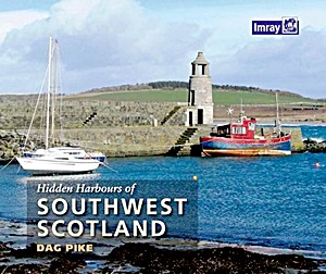
Hidden Harbours of Southwest Scotland

A a lively tour of small and infrequently visited harbours on the stunning Scottish coast and its nearby islands, starting from Port Logan in the south and meandering northwards to Lerags on Loch Feochan in the Firth of Lorn.
The southwest coast of Scotland is one of the most beautiful cruising areas in the world, combining dramatic scenery with interesting history and landmarks. Many of its shores are lined with old castles and the magnificent historical houses of rich industrialists, reflecting its significance as an area of busy trade.
The more recent military developments, which include a wartime torpedo base at Loch Long and the naval headquarters at Faslane on Gare Loch, also have a significant presence.

Small harbours further south were shaped by the trade in natural resources and the flow of passengers via Clyde Puffer boats to and from nearby cities such as Glasgow and beyond.

Each hidden harbour, many of which are simple but attractive piers or shipways built to support trade, has a story to tell. The book includes a historical overview plus notes on what is to be found at each, alongside full colour photographs and annotated aerial shots.
This edition complements the other Hidden Harbours titles in the series by Dag Pike.

Dettagli

Autore:Dag Pike
Formato:64 pagine, 21 x 25.5 x 1.1 cm, brossura
Illustrazioni:riccamente illustrato con foto in colori e mappe
Lingua:inglese
Editore:Imray, Laurie, Norie & Wilson Ltd (GB, 2015)
ISBN:9781846237027
Copertina del libro: Hidden Harbours of Southwest Scotland | Imray

Hidden Harbours of Southwest Scotland

Lingua: inglese

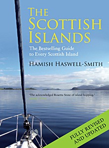
The Scottish Islands: The Bestselling Guide to Every Scottish Island

Fully revised and updated, this is the only book with detailed information and maps on every Scottish island. With the author's own paintings illustrating it, this beautiful guide will take you everywhere, whether by armchair or yacht.

From the abandoned crofts of Mingulay and the standing stones of Orkney to the white beaches of Colonsay, this is the first complete gazetteer to cover all of Scotland's many hundreds of islands, including those which are uninhabited and those which are notoriously difficult to reach.

Packed with information on access, anchorages, points of historical or natural interest and things to do and see, this fascinating compendium provides indispensable information for touring, for browsing, for reference, and for all of those travellers who wish to experience some of the most beautiful and remote places in the world.

No other book begins to emulate the range and depth of the information contained in The Scottish Islands. Illustrated with full-colour illustrations and relief maps of all the main islands, this is both an impressive work of reference and a fascinating personal view of Scotland's distant outposts.

Dettagli

Autore:Hamish Haswell-Smith
Formato:532 pagine, 27 x 20 x 3.9 cm, copertina rigida
Illustrazioni:riccamente illustrato
Lingua:inglese
Editore:Canongate Books Ltd (GB, 2015)
ISBN:9781782116783
Copertina del libro: The Scottish Islands: The Bestselling Guide to Every Scottish Island | Canongate

The Scottish Islands: The Bestselling Guide to Every Scottish Island

Lingua: inglese

Map of the Inland Waterways of Scotland - Caledonian Canal, Forth & Clyde Canal, Crinan Canal

The second edition of Imray's Map of the Inland Waterways of Scotland has been updated. Contact details for the new Scottish Waterways body that replaces British Waterways have been added. The descriptive text has been improved with the addition of more photos.

Dettagli

Autore:Jane Cumberlidge
Formato:1 pagine, 22.5 x 15 x 1 cm, mappa (piegata)
Illustrazioni:riccamente illustrato con foto in colori e mappe
Lingua:inglese
Editore:Imray, Laurie, Norie & Wilson Ltd (GB, 2013)
ISBN:9781846235221
Copertina del libro: Map of the Inland Waterways of Scotland - Caledonian Canal, Forth & Clyde Canal, Crinan Canal | Imray

Map of the Inland Waterways of Scotland - Caledonian Canal, Forth & Clyde Canal, Crinan Canal

Lingua: inglese

Titoli correlati:

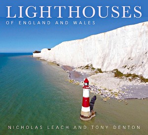
Copertina del libro: Lighthouses of England and Wales

Lighthouses of England and Wales

Nicholas Leach , Tony Denton | inglese | copertina rigida | 336 p. | 2018

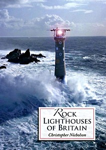
Copertina del libro: Rock Lighthouses of Britain

Rock Lighthouses of Britain

Christopher Nicholson | inglese | brossura | 208 p. | 2014

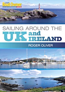
Copertina del libro: Sailing Around the UK and Ireland (Practical Boat Owner)

Sailing Around the UK and Ireland (Practical Boat Owner)

Roger Oliver | inglese | brossura | 176 p. | 2011