Lorsque vous commandez via les boutons de cette page, nous pouvons percevoir une petite commission sans frais supplémentaires pour vous. En savoir plus >

Guides nautiques - Pays-Bas : navigation et ports

Un guide nautique pour vos vacances en bateau aux Pays-Bas ? Découvrez ici des guides pour la navigation, les ports et les attractions touristiques.

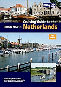
Cruising Guide to the Netherlands (5th edition)

This is the fifth editon of 'Cruising Guide to the Netherlands' which was first published in 1988. It is regarded as the authoritative companion for anyone cruising the Netherlands using fixed mast routes.

Brian Navin's guide is based on popular selected routes which offer an opportunity to visit most of the regions of the Netherlands from the estuary of the Schelde up to the IJsselmeer and Waddensee.

This new edition follows the same pattern, and includes corrections and updates that have accumulated since the fourth edition was published. This includes amended harbour plans and new photographs taken by the author.

Caractéristiques

Auteur :Brian Navin
Présentation :203 pages, 29.5 x 21 x 1.5 cm, broché
Illustration :abondamment illustré avec des photos et des cartes et couleurs
Editeur :Imray, Laurie, Norie & Wilson Ltd (GB, 2010)
ISBN:9781846231858
Livre: Cruising Guide to the Netherlands (5th edition)

Cruising Guide to the Netherlands (5th edition)

Langue : anglais

Acheter sur Amazon FR
Acheter sur Amazon BE
Acheter sur Amazon CA

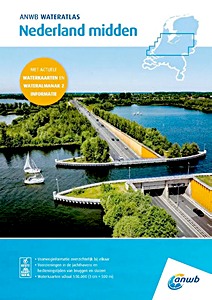
ANWB Wateratlas - Nederland Midden

NOUVEAU

L'"ANWB Wateratlas Nederland Midden" est une référence indispensable pour les amateurs de sports nautiques. Cet atlas combine les célèbres cartes nautiques ANWB et les informations du Wateralmanak partie 2. Avec les cartes nautiques intégrées, vous naviguez facilement sur les lacs et les rivières et trouvez rapidement des informations sur les marinas et les horaires de fonctionnement des ponts et des écluses.

Le Wateratlas Nederland Midden comprend:
- Informations sur les voies navigables
- Installations dans les marinas
- Horaires de fonctionnement des ponts et des écluses
- Cartes nautiques (échelle 1: 50.000, 1 cm = 500 m)

Caractéristiques

Auteur :ANWB
Présentation :120 pages, 42 x 30.5 x 1.2 cm, broché
Editeur :ANWB (NL, 2025)
ISBN:9789018054076
Livre: ANWB Wateratlas - Nederland Midden

ANWB Wateratlas - Nederland Midden

Langue : néerlandais

Acheter sur Amazon FR
Acheter sur Amazon BE

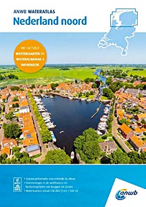
ANWB Wateratlas - Nederland Noord

NOUVEAU

L'ANWB Wateratlas Nederland Noord (Atlas Nautique ANWB Pays-Bas Nord) est un guide compact et pratique pour les amateurs de navigation. Il regroupe les cartes nautiques ANWB et les informations de l'Almanach Nautique, partie 2. Vous pouvez ainsi naviguer facilement sur les lacs et rivières et accéder rapidement aux informations sur les ports de plaisance et les horaires d'ouverture des ponts et écluses.

Cet atlas nautique comprend:
- Informations sur les voies navigables
- Équipements dans les ports de plaisance
- Horaires d'ouverture des ponts et écluses
- Cartes nautiques à l'échelle 1: 50 000 (1 cm = 500 m)

Caractéristiques

Auteur :ANWB
Présentation :120 pages, 42 x 30 x 1 cm, broché
Editeur :ANWB (NL, 2025)
ISBN:9789018054069
Livre: ANWB Wateratlas - Nederland Noord

ANWB Wateratlas - Nederland Noord

Langue : néerlandais

Acheter sur Amazon FR
Acheter sur Amazon BE

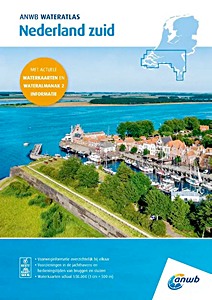
ANWB Wateratlas - Nederland Zuid

NOUVEAU

"ANWB Wateratlas Nederland Zuid" est un guide compact et pratique pour les amateurs de navigation. Il regroupe les cartes nautiques ANWB et les informations de l'Almanach Nautique, partie 2. Vous pouvez ainsi naviguer facilement sur les lacs et rivières et accéder rapidement aux informations sur les ports de plaisance et les horaires d'ouverture des ponts et écluses.

Cet atlas nautique comprend:
- Informations sur les voies navigables
- Équipements dans les ports de plaisance
- Horaires d'ouverture des ponts et écluses
- Cartes nautiques à l'échelle "1: 50 000" (1 cm = 500 m)

Caractéristiques

Auteur :ANWB
Présentation :120 pages, 42 x 30.5 x 1 cm, broché
Editeur :ANWB (NL, 2025)
ISBN:9789018054083
Livre: ANWB Wateratlas - Nederland Zuid

ANWB Wateratlas - Nederland Zuid

Langue : néerlandais

Acheter sur Amazon FR
Acheter sur Amazon BE

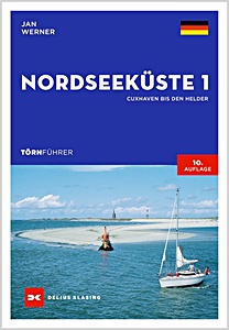
Törnführer Nordseeküste 1 - Cuxhaven bis Den Helder

NOUVEAU

La mer du Nord est une zone de navigation attractive mais exigeante. Le guide de Jan Werner présente les meilleures routes de Cuxhaven à Den Helder. Les particularités des eaux à marée en Allemagne et aux Pays-Bas sont expliquées en détail, permettant aux débutants de naviguer en toute sécurité.
Les zones couvertes incluent Helgoland, Weser, Jade et Jadebusen, la mer des Wadden de Frise orientale, l'Ems avec Borkum, la Waddenzee néerlandaise et les îles de Frise occidentale. Toutes les informations essentielles sur les ports sont fournies, y compris les approches, services, installations et sites touristiques.

La 9e édition explique également de manière claire les bases de la navigation et de la conduite en eaux à marée. Les données actualisées facilitent la planification et l'orientation sur place.
La mer du Nord offre aux navigateurs expérimentés et débutants des croisières variées, des paysages impressionnants et des défis liés aux marées et aux conditions météo changeantes. Avec ce guide pratique à bord, vous êtes bien préparé pour naviguer en toute sécurité et profiter pleinement de la mer du Nord.

Caractéristiques

Auteur :Jan Werner
Présentation :272 pages, 24 x 17 x 1.7 cm, broché
Illustration :128 en couleurs, 100 cartes et couleurs
Editeur :Delius Klasing Verlag GmbH (D, 2024)
ISBN:9783667121745
Livre: Törnführer Nordseeküste 1 - Cuxhaven bis Den Helder

Törnführer Nordseeküste 1 - Cuxhaven bis Den Helder

Langue : allemand

Acheter sur Amazon FR
Acheter sur Amazon BE
Acheter sur Amazon CA

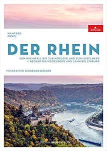
Der Rhein - Vom Rheinfall bis zur Nordsee und zum IJsselmeer. Neckar bis Heidelberg und Lahn bis Limburg

Du Rhin supérieur jusqu'aux Pays-Bas : le Rhin et ses affluents offrent de nombreuses possibilités pour les vacances nautiques. Que ce soit pour un week-end le long des vignobles ou un long parcours jusqu'au lac IJsselmeer, une bonne planification est essentielle.

La 9e édition du guide fluvial reconnu de Manfred Fenzl fournit toutes les informations nécessaires pour une croisière détendue sur le Rhin. Le guide couvre tous les tronçons du Rhin - depuis les chutes du Rhin à Schaffhouse jusqu'à l'embouchure en mer du Nord - ainsi que les affluents : Haut-Rhin, Rhin supérieur, Rhin moyen, Bas-Rhin, Neckar jusqu'à Heidelberg, Lahn jusqu'à Limburg, Gelderse IJssel et Maas.

Des cartes détaillées avec distances, écluses, hauteurs de ponts, stations-service, rampes et emplacements d'amarrage facilitent la navigation. De nombreuses photos et de courts textes pour chaque cours d'eau permettent une orientation facile.
Avec ce guide, les plaisanciers disposent de toutes les informations pour naviguer sur le Rhin en toute sécurité et profiter pleinement de leur croisière.

Caractéristiques

Auteur :Manfred Fenzl
Présentation :208 pages, 30 x 21.5 x 2.2 cm, relié
Illustration :140 cartes
Editeur :Edition Maritim (D, 2022)
ISBN:9783667121608
Livre: Der Rhein - Vom Rheinfall bis zur Nordsee und zum IJsselmeer. Neckar bis Heidelberg und Lahn bis Limburg

Der Rhein - Vom Rheinfall bis zur Nordsee und zum IJsselmeer. Neckar bis Heidelberg und Lahn bis Limburg

Langue : allemand

Acheter sur Amazon FR
Acheter sur Amazon BE
Acheter sur Amazon CA

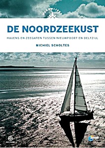
Vaarwijzer: De Noordzeekust

The coast of the Low Countries is one of the most dangerous in the world. There is hardly any place to shelter. Currents, breakers and swell can pose a great danger and there are sandbanks in inconvenient places. Michiel Scholtes travelled from Nieuwpoort to Delfzijl and wrote a practical reference work with which sailors can approach ports and sea inlets in the area in a responsible manner.
In this Vaarwijzer you can read not only about the dangers, but also about the great pleasure of a beautiful trip along the dune row. An indispensable book on board for anyone who ventures out to sea.

In 2020, Peter Schermer sailed the coastal area again in the wake of Michiel Scholtes. He carefully noted the changes in the approaches to a safe harbour and has incorporated them into this new edition.

Many thousands of water sports enthusiasts have experienced successful boat trips and holidays in recent years with the help of the practical Vaarwijzer guides. The series is compiled by experienced sailors in the relevant sailing area. The authors want to inspire readers and provide them with all the necessary information to be able to prepare a trip well.

Fourth, revised edition

Caractéristiques

Auteur :Michiel Scholtes
Présentation :207 pages, 25 x 17.5 x 2 cm, relié
Illustration :abondamment illustré avec des photos et des cartes et couleurs
Editeur :Gottmer Uitgevers Groep BV (NL, 2021)
Série :Hollandia Vaarwijzer
ISBN:9789064107207
Livre: Vaarwijzer: De Noordzeekust

Vaarwijzer: De Noordzeekust

Langue : néerlandais

Acheter sur Amazon FR
Acheter sur Amazon BE

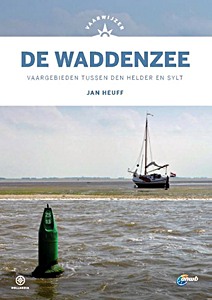
Vaarwijzer: De Waddenzee - Vaargebieden tussen Den Helder en Sylt

The "Vaarwijzer De Waddenzee" has been the reference work for all water sports enthusiasts who want to sail between Den Helder and Sylt for decades. This waterway, however beautiful, can be very changeable. Author Jan Hueff lives on Terschelling and keeps a close eye on the changes in channels, tidal flats and harbours on all his sailing trips.
This new edition is designed in the new house style of the Vaarwijzer series and has been completely updated and up-to-date.

Many thousands of water sports enthusiasts have experienced successful boat trips and holidays in recent years with the help of the practical Vaarwijzer guides. The series is compiled by experienced sailors in the relevant sailing area. The authors want to inspire readers and provide them with all the necessary information to be able to prepare a trip well.

Caractéristiques

Auteur :Jan Heuff
Présentation :200 pages, 24.5 x 17.5 x 1.9 cm, relié
Illustration :abondamment illustré avec des photos en couleurs
Editeur :Gottmer Uitgevers Groep BV (NL, 2021)
Série :Hollandia Vaarwijzer
ISBN:9789064107191
Livre: Vaarwijzer: De Waddenzee - Vaargebieden tussen Den Helder en Sylt

Vaarwijzer: De Waddenzee - Vaargebieden tussen Den Helder en Sylt

Langue : néerlandais

Acheter sur Amazon FR
Acheter sur Amazon BE
Acheter sur Amazon CA

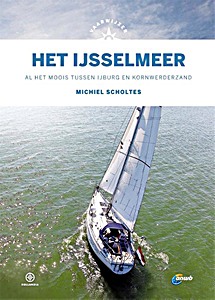
Vaarwijzer: Het IJsselmeer - Al het moois tussen IJburg en Kornwederzand

For many sailors, the IJsselmeer is the first major waterway from the lakes. However, most water sports enthusiasts only sail along the main harbours, while there is so much beauty to be found off the beaten track.
In addition to all the information about the well-known harbours and routes, this Vaarwijzer also tries to tempt the reader to discover lesser-known places. This new edition is completely up-to-date again, including the new sailing area around the Marker Wadden, so that everyone can enjoy themselves on their own water this summer.

Many thousands of water sports enthusiasts have experienced successful boat trips and holidays in recent years with the help of the practical Vaarwijzer guides. The series is compiled by experienced sailors in the relevant sailing area. The authors want to inspire readers and provide them with all the necessary information to be able to prepare a trip well.

Caractéristiques

Auteur :Michiel Scholtes
Présentation :159 pages, 25 x 17.5 x 1.4 cm, relié
Illustration :abondamment illustré avec des photos et des cartes et couleurs
Editeur :Gottmer Uitgevers Groep BV (NL, 2021)
Série :Hollandia Vaarwijzer
ISBN:9789064107412
Livre: Vaarwijzer: Het IJsselmeer - Al het moois tussen IJburg en Kornwederzand

Vaarwijzer: Het IJsselmeer - Al het moois tussen IJburg en Kornwederzand

Langue : néerlandais

Acheter sur Amazon FR
Acheter sur Amazon BE

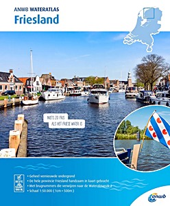
ANWB Wateratlas - Friesland

Les cartes et atlas nautiques ANWB sont une référence dans le monde du nautisme. Aucun navigateur ne part aux Pays-Bas sans ces informations fiables. Cet atlas nautique est particulièrement utile en Frise et contient:

- Cartes nautiques détaillées et précises
- Numéros de ponts référencés dans l'Almanach Nautique 2
- Liste des ports de plaisance
- Informations sur les profondeurs de navigation autorisées
- Vitesses maximales autorisées par zone
- Cartes détaillées des principales localités
- Légende claire

Caractéristiques

Auteur :ANWB
Présentation :33 pages, 30 x 24.5 x 0.5 cm, broché
Editeur :ANWB (NL, 2020)
ISBN:9789018045951
Livre: ANWB Wateratlas - Friesland

ANWB Wateratlas - Friesland

Langue : néerlandais

Acheter sur Amazon FR
Acheter sur Amazon BE

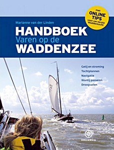
Handboek varen op de Waddenzee

The "Handboek varen op de Waddenzee" is one of the most successful Hollandia publications of recent years. The book has been enthusiastically received in the water sports world and has proven itself as a fully-fledged standard work.

This new edition has been completely updated and is up-to-date and will show both new and advanced sailors the way on the Wadden Sea. Sailing on the Wadden Sea remains a challenge for many water sports enthusiasts and this book offers the knowledge you need for this.

Special attention to:
- Tides and currents
- Trip plans
- Navigation
- Passing the Wantij
- Running aground.

Caractéristiques

Auteur :Marianne van der Linden
Présentation :224 pages, 28 x 21.5 x 2 cm, relié
Illustration :abondamment illustré
Editeur :Gottmer Uitgevers Groep BV (NL, 2019)
ISBN:9789064106576
Livre: Handboek varen op de Waddenzee

Handboek varen op de Waddenzee

Langue : allemand

Acheter sur Amazon FR

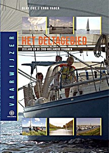
Vaarwijzer: Het Deltagebied - Zeeland en de Zuid-Hollandse stromen

Tussen Dordrecht en Zeeuws-Vlaanderen ligt een vaargebied van ongekende variatie. Voor veel watersporters is de Delta het eerste gebied waar ze geconfronteerd worden met echt stromend water.
Voor wie voorzichtig wil beginnen zijn er de afgesloten zeearmen, zoals de Grevelingen en het Veerse Meer. Maar voor iedereen die de eerste stappen van het zeilen op groot water goed doorstaan heeft, vormen natuurlijk de Oosterschelde en de Westerschelde, met hun getijden en grote oppervlakten aan open water, het echte werk.
En voor wie nog verder wil, ligt voor de Zeeuwse kust een uitdagend deel van de Noordzee te wachten.

Olav Cox zeilde met zijn gezin rond de wereld en schreef hierover het reisverhaal "Ritme van de oceaan". Voor het samenstellen van deze Vaarwijzer keerde hij terug naar zijn thuiswateren.
De serie Hollandia Vaarwijzers wordt samengesteld door routiniers in het betreffende vaargebied. De auteurs willen lezers inspireren en hun daarbij alle noodzakelijk informatie verschaffen om een tocht goed te kunnen voorbereiden.

Caractéristiques

Auteur :Olav Cox - Erna Vader
Présentation :192 pages, 24.5 x 17.5 x 1.7 cm, relié
Illustration :abondamment illustré avec des photos en couleurs
Editeur :Gottmer Uitgevers Groep BV (NL, 2018)
Série :Hollandia Vaarwijzer
ISBN:9789064106460
Livre: Vaarwijzer: Het Deltagebied - Zeeland en de Zuid-Hollandse stromen

Vaarwijzer: Het Deltagebied - Zeeland en de Zuid-Hollandse stromen

Langue : néerlandais

Acheter sur Amazon FR
Acheter sur Amazon BE
< >

Autres livres dans cette catégorie :

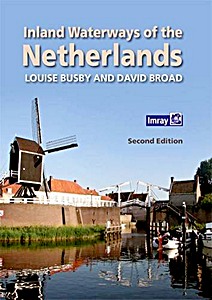
Inland Waterways of the Netherlands

Inland Waterways of the Netherlands (2nd Edition)

Louise Busby, David Broad | anglais | relié | 300 p. | 2016

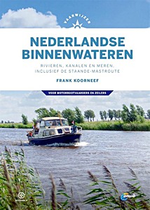
Vaarwijzer Nederlandse binnenwateren

Vaarwijzer Nederlandse binnenwateren - Rivieren, kanalen en meren, inclusief de staande-mastroute

Frank Koorneef | néerlandais | relié | 296 p. | 2020

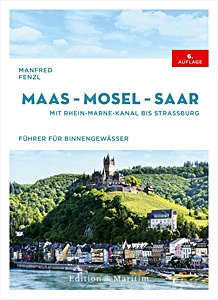
Maas - Mosel - Saar

NOUVEAU

Maas - Mosel - Saar - Mit Rhein-Marne-Kanal bis Straßburg

Manfred Fenzl | allemand | relié | 272 p. | 2025

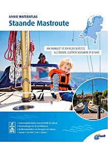
ANWB Wateratlas - Staande Mastroute

NOUVEAU

ANWB Wateratlas - Staande Mastroute

ANWB | néerlandais | broché | 61 p. | 2024

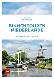
Binnentouren Niederlande - Stehende Mastroute

NOUVEAU

Binnentouren Niederlande - Stehende Mastroute

Frank Koorneef | allemand | broché | 176 p. | 2024

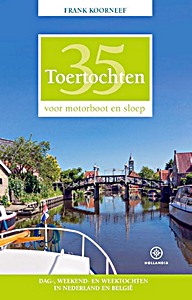
35 Toertochten voor motorboot en sloep

35 Toertochten voor motorboot en sloep - Dag-, weekend- en weektochten in Nederland en België

Frank Koorneef | néerlandais | broché | 352 p. | 2019

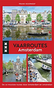
Vaarroutes Amsterdam

Vaarroutes Amsterdam - De 10 mooiste routes door Amsterdam en omstreken

Frank Koorneef | néerlandais | broché | 127 p. | 2017

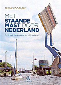
Met staande mast door Nederland

Met staande mast door Nederland - Ontdek de binnenwateren met je zeilschip

Frank Koorneef | néerlandais | broché | 144 p. | 2016