Guides nautiques - Grande-Bretagne : navigation et ports

Un guide nautique pour vos vacances en bateau en Grande-Bretagne ? Découvrez ici des guides pour la navigation, les ports et les attractions touristiques.

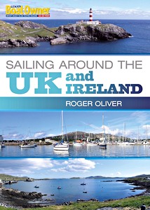
Sailing Around the UK and Ireland (Practical Boat Owner)

Based on a highly successful series of articles in Practical Boat Owner magazine, this is a detailed practical guide to sailing around the UK - all by means of day sails. Roger Oliver, a passionate sailor, explains his in-depth passage planning, boat preparations, weather checks and log-keeping, as well as his choice of routes, the detailed navigation, sail trim tips and on-passage maintenance, all for the benefit of sailors who have a yen to follow in his footsteps.

Packed with a wealth of practical tips on seamanship, anchoring in high winds, coping with big seas, problem-solving, harnessing the tide, sailing short-handed and living aboard for extended cruising, this book will be a godsend to the many thousands of sailors who enjoy coastal cruising and who will discover (as did Roger) that it is perfectly possible to cruise around the whole of the UK in a series of day sails.

With this book to hand, and inspired by Roger's detailed route maps and spectacular photographs, anyone can experience the thrill and enjoyment of sailing around the beautiful and varied UK coast from any starting point.

Auteur :Roger Oliver
Présentation :176 pages, 29.5 x 21 x 1.3 cm, broché
Illustration :abondamment illustré avec des photos et des dessins en couleurs
Editeur :Bloomsbury Publishing PLC (GB, 2011)
ISBN:9781408137130
Sailing Around the UK and Ireland (Practical Boat Owner)

Sailing Around the UK and Ireland (Practical Boat Owner)

Langue : anglais

Acheter sur Amazon FR
Acheter sur Amazon BE
Acheter sur Amazon CA

Sailing Around Britain - A Weekend Sailor's Voyage in 50 Day Sails (2nd edition)

Kim Sturgess was a weekend sailor: he enjoyed club racing and several brief sailing holidays, but had never attempted a substantial expedition. Reaching the age of fifty focused the mind and he decided to sail around Britain. While many cruising sailors would not contemplate a 1900 nautical mile voyage, he broke the voyage into a series of day sails, making it an achievable ambition for him, largely single-handed, and for many other weekend sailors who might dream of sailing around their home island.

This book tells the quirky traveller's narrative of the voyage and visits to forty-eight towns. Evoking the spirit of both Jerome K. Jerome with his Three Men in a Boat and Joshua Slocum's Sailing Alone Around the World, Kim shares his thoughts and struggles, recounting how easy it is for anyone to become an adventurer here at home.

Auteur :Kim Sturgess
Présentation :248 pages, 20 x 13 x 1.9 cm, broché
Illustration :16 en couleurs, 6 cartes
Editeur :Fernhurst Books (GB, 2017)
ISBN:9781912177059
Sailing Around Britain - A Weekend Sailor's Voyage in 50 Day Sails (2nd edition)

Sailing Around Britain - A Weekend Sailor's Voyage in 50 Day Sails (2nd edition)

Langue : anglais

Acheter sur Amazon FR
Acheter sur Amazon BE
Acheter sur Amazon CA

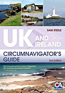
UK and Ireland - Circumnavigator's Guide (2nd Edition)

A circumnavigation of the UK and Ireland is the perfect 'doorstep' challenge for sailors and motorboaters looking for an extended cruise which doesn't take them too far from family and responsibilities and allows them to keep in touch. It doesn't require extended time off work, or linguistic ability if things go wrong - and the coastline is beautiful!

This book is a practical guide and Sam gives advice on planning and preparation: when to leave, whether to go clockwise or anti, what charts are needed, how much it is likely to cost, possible routes (via canals or 'the long way'), what stores and equipment are needed, likely pitfalls en route, and what types of running maintenance might be required. For the second edition she has added a '10 of the best' section detailing 'unmissable' places in a range of categories from remote bays and beautiful rivers to historic locations and anchorages.
UK and Ireland Circumnavigator's Guide is perfect for all those sailors and motorboaters planning as well as dreaming of one day circumnavigating Britain's beautiful islands.

Auteur :Sam Steele
Présentation :240 pages, 24.5 x 17 x 1.7 cm, broché
Illustration :abondamment illustré avec des photos et des cartes et couleurs
Editeur :Bloomsbury Publishing PLC (GB, 2011)
ISBN:9781408131411
UK and Ireland - Circumnavigator's Guide (2nd Edition)

UK and Ireland - Circumnavigator's Guide (2nd Edition)

Langue : anglais

Acheter sur Amazon FR
Acheter sur Amazon BE
Acheter sur Amazon CA

Sea Charts of the British Isles - A Voyage of Discovery Around Britain & Ireland's Coastline

Travelling along the British coastline, "Sea Charts of the British Isles" showcases a beautiful collection of charts containing a wealth of information about Britain's maritime history and the story of charting and surveying itself.
The great names in British chart-making are all included, such as Captain Greenvile Collins, Professor Murdoch Mackenzie and his nephew of the same name, Graeme Spence and William Bligh who between them created the first structured attempts to survey and chart particular areas of the coast of mainland Britain as well as the more remote islands.

Examples include several from Collins' 'Great Britain's Coastal Pilot', such as:
- charts of Edinburgh and the Forth, the Orkney Islands, the coast of Ireland and the River Thames;
- the Chart of the Coast of Wales in St George's Channel and that of Milford Haven by Lewis Morris;
- The River Clyde and Glasgow by John Watt;
- the Observation by Trinity House Pilots and Surveyors of the Downs covering the coast of Kent and the Goodwin Sands.
There are also charts by other well-known European chart-makers such as the magnificent example of the Coast of England from Dover to the Isle of Wight showing the Cinque Ports by Lucas Janszoon Wagenaer that dates from 1583.

The author has researched maritime archives such as the Admiralty Library, the National Maritime Museum, the Pepys Library, the UK Hydrographic Office and the National Archives to reveal their unseen nautical records and portray the development of the sea chart.

Auteur :John Blake
Présentation :128 pages, 28 x 24.5 x 1.3 cm, broché
Illustration :110+ cartes et dessins en couleurs
Editeur :Bloomsbury Publishing PLC (GB, 2016)
ISBN:9781472944900
Sea Charts of the British Isles - A Voyage of Discovery Around Britain & Ireland's Coastline

Sea Charts of the British Isles - A Voyage of Discovery Around Britain & Ireland's Coastline

Langue : anglais

Acheter sur Amazon FR
Acheter sur Amazon BE
Acheter sur Amazon CA

Lighthouses of England and Wales

England and Wales have long been captivated by the lighthouse, with many of the towers built at the countries' extremities seen as iconic structures. Lighthouses have seized the imagination for centuries, and have cut striking figures wherever they stand. Newly revised and wholly redesigned, "Lighthouses of England and Wales" is a complete guide to the lighthouses of England, Wales and the Channel Islands in one spectacular volume.

Alongside stunning photographs are pocket histories and statistics for each lighthouse, tower and aid to navigation - large or small - as well as details of how to visit them. Whether you are a lighthouse aficionado, coastal walker, or just someone with an eye for a beautiful view, this is a book not to be missed.

Auteur :Nicholas Leach , Tony Denton
Présentation :336 pages, 24.5 x 224 cm, relié
Illustration :600 photos et dessins
Editeur :The History Press Ltd (GB, 2018)
ISBN:9780750986977
Lighthouses of England and Wales

Lighthouses of England and Wales

Langue : anglais

Acheter sur Amazon FR
Acheter sur Amazon BE
Acheter sur Amazon CA

Rock Lighthouses of Britain

This handsome book remains an essential part of any lighthouse or maritime enthusiast's library and will also be of huge appeal to anyone interested in maritime/British history or looking for an enthralling read.

Contains a large number of stunning colour photographs as well as beautiful 19th century plans and drawings in colour.

Auteur :Christopher Nicholson
Présentation :208 pages, 29.5 x 21 cm, broché
Illustration :abondamment illustré avec 150 photos et dessins en couleurs
Editeur :Whittles Publishing (GB, 2014)
ISBN:9781849951371
Rock Lighthouses of Britain

Rock Lighthouses of Britain

Langue : anglais

Acheter sur Amazon FR
Acheter sur Amazon BE
Acheter sur Amazon CA
Autres livres dans cette catégorie :

East Coast Pilot - Great Yarmouth to Ramsgate

East Coast Pilot - Great Yarmouth to Ramsgate

Garth Cooper, Dick Holness | anglais | broché | 168 p. | 2019

Norfolk, The Wash and Humber

Norfolk, The Wash and Humber - Lowestoft to Spurn Head

Peter Harvey | anglais | broché | 96 p. | 2022

Cook's Country - Spurn Head to St Abbs

Cook's Country - Spurn Head to St Abbs

Henry Irving | anglais | broché | 50 p. | 2016

Lighthouses of the East Coast

Lighthouses of the East Coast - East Anglia and Lincolnshire

Robin Jones | anglais | relié | 144 p. | 2013


Dernière actualisation : 2024-11-22