Guides nautiques - Angleterre: rivière Tamise

Un guide pour votre croisière sur la Tamise en Angleterre ? Découvrez ici des guides pour la navigation, les ports de plaisance et les attractions touristiques.

London's Waterways

London boasts not only one of the most famous and awe-inspiring rivers of the world, but is also home to beautiful and majestic canals such as the Grand Union and Regents Canal - ever popular with tourists and increasingly sought-after by waterside residents.
Tucked away in the city are also lesser-known (and in some cases completely hidden) waterways, which this book magically opens up for the reader. Rivers flow through shopping centres and across tube platforms as well as creating surprisingly rural settings within the capital.

This visually stunning and often unexpected look at the iconic landscapes, beautiful scenery and secret places all around London's waterways is the first book of its kind. By the same author as the popular Waterways Past and Present and The Thames: A Photographic Journey from Source to Sea, this book teems with fabulous photography and fascinating information, giving readers a unique insight into both well-loved and relatively unexplored aspects of London.
With its stylish design, beautiful photography and quirky captions, this gorgeous coffee table book is the perfect gift for inland waterways enthusiasts, as well as tourists and Londoners.

Auteur :Derek Pratt
Présentation :160 pages, 26 x 25.5 x 1.9 cm, relié
Illustration :abondamment illustré avec des photos en couleurs
Editeur :Bloomsbury Publishing PLC (GB, 2010)
ISBN:9781408110744

The River Thames - A guide for river users

The River Thames Book, now in its 8th edition, is the best-selling guide to the non-tidal Thames from Teddington to its source in Gloucestershire. This complete guide covers the Barrier to Cricklade with the River Wey, Basingstoke Canal and the Kennet & Avon Canal to Great Bedwyn.

Chris Cove-Smith's updated text describes the navigation with support of clear and detailed mapping. The River Thames Book also lists in exhaustive detail the facilities to be found along each section of the navigation.

Auteur :Chris Cove-Smith
Présentation :235 pages, 23.5 x 16.5 x 1.9 cm, reliure spirale
Illustration :abondamment illustré avec des photos et des cartes et couleurs
Editeur :Imray, Laurie, Norie & Wilson Ltd (GB, 2022)
ISBN:9781786791849
The River Thames - A guide for river users

The River Thames - A guide for river users

Langue : anglais

Acheter sur Amazon FR
Acheter sur Amazon BE
Acheter sur Amazon CA

Map of the River Thames - From the Source to Hammersmith Bridge

This popular map of the non-tidal Thames from its the source above Cricklade to the entrance of the Grand Union Canal at Brentford below Teddington Locks is convenient in any cockpit and is the ideal companion to Chris Cove-Smith's River Thames Book.

Full information on boating facilities is included in the mapping, as are all the essential details on restricting dimensions, locks and bridges. Also shown are pubs, the Thames Path and other features of special interest.
Large-scale insets of Oxford, Abingdon, Reading, Henley, Windsor and Eton, the River Wey junction and the entrance to the Grand Union Canal add to the clarity of this well presented map.

Présentation :1 pages, 25 x 17.5 x 2.4 cm, carte (pliée)
Illustration :abondamment illustré avec des photos et des cartes et couleurs
Editeur :Imray, Laurie, Norie & Wilson Ltd (GB, 2021)
ISBN:9781786792532
Map of the River Thames - From the Source to Hammersmith Bridge

Map of the River Thames - From the Source to Hammersmith Bridge

Langue : anglais

Acheter sur Amazon FR
Acheter sur Amazon BE
Acheter sur Amazon CA

Crossing the Thames Estuary - 60 fully explained routes and simplified passage planning tables

The Thames Estuary is a complex and challenging area with narrow channels, shoal waters, determined tides and shifting sands, plus busy shipping traffic, three major ports and six wind farms in and around it. But its waters are also fascinating, interesting and have a wide selection of destinations to enjoy.
This book describes 60 safe, viable and feasible routes between the Kent, Essex and Suffolk rivers for safe passage and wholly new time-planning tables which are now simplified with significantly additional and readily available information.

The third edition retains all the popular features describing and illustrating each sector of each route, with waypoints and 'rolling road' diagrams, providing information and advice about potential or permanent hazards, the implications for the tide and guidance about shipping routes and anchorages.

Included are new and unique passage planning tables which are simple, accurate and quick to use. Readers can select the most appropriate start time and will instantly see predicted arrival time so as to have sufficient time to continue up river to an ultimate destination.
Options are offered for every 30 minutes of the day, whatever the day. The tables not only provide the best predicted start time - for the quickest passage duration - for each route at 4, 5, 6 or 7 knots boat speed, but display alternative passage durations, whatever the tide.

Tables provide easier access and a much broader basis of information than in earlier editions, presented alongside more detailed chartlets and a new portrait format book.
Sailors benefit from swatchways in the Estuary which shorten time and distance for many passages. However, as they're liable to move or change as sands shift, the author endeavours to survey several critical swatchways, monitors and provides illustrated Notices to Mariners weekly and receives reports from readers. Any significant changes or downloads are reported by updates on the website or by email to readers on the 'Readers' Update' list.

Auteur :Roger Gaspar
Présentation :268 pages, 30 x 22.5 x 2 cm, reliure spirale
Illustration :abondamment illustré avec des photos et des cartes et couleurs
Editeur :Imray, Laurie, Norie & Wilson Ltd (GB, 2022)
ISBN:9781786793195
Crossing the Thames Estuary - 60 fully explained routes and simplified passage planning tables

Crossing the Thames Estuary - 60 fully explained routes and simplified passage planning tables

Langue : anglais

Acheter sur Amazon FR
Acheter sur Amazon BE
Acheter sur Amazon CA

The Thames - A Photographic Journey from Source to Sea

The Thames is unique, emerging as a small stream in idyllic countryside and growing into the country's largest river, passing through some of the world's most iconic urban environments. Linking London to the countryside and the sea, the Thames is the heart of the capital and its waters the lifeblood of England.

This beautiful book celebrates the entire river from source to sea, and with wonderful photography and quirky text follows it on a voyage through Britain's history. London has so often been the beginning and the end of the Thames story, and whilst it forms a major part, this book gives an altogether more complete and unexpected view of one of the most remarkable and well-loved rivers in the world.
We see the famous views and also learn lesser-known facts, such as Dick Turpin's secret hideaway (complete with an underground stable for Black Bess), the home of the notorious Chancellor Sir Francis Dashwood (the only Chancellor to have delivered his budget speech drunk) and the scene of the Monty Python fish-slapping dance.
First published in 2007, this gorgeous coffee table book has been updated for its second edition with new text and photography (including the Jubilee pageant), and continues to be the perfect gift for anyone living near, visiting or enjoying this magnificent river, with its visual variety, hidden secrets and fascinating history.

Auteur :Derek Pratt
Présentation :160 pages, 26 x 26 x 2 cm, relié
Illustration :abondamment illustré avec des photos en couleurs
Editeur :Bloomsbury Publishing PLC (GB, 2013)
ISBN:9781408186930
The Thames - A Photographic Journey from Source to Sea

The Thames - A Photographic Journey from Source to Sea

Langue : anglais

Acheter sur Amazon FR
Acheter sur Amazon BE
Acheter sur Amazon CA

Autres livres dans cette catégorie :

The River Great Ouse and its tributaries

The River Great Ouse and its tributaries

Chris Howes | anglais | relié | 264 p. | 2021

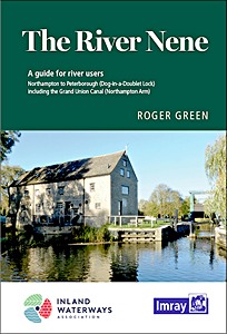
The River Nene - A guide for river users

The River Nene - A guide for river users

Roger Green | anglais | broché | 2020


Dernière actualisation : 2024-11-20