Al comprar mediante los enlaces, apoyas este sitio sin coste adicional para usted. Más información >

Guías de navegación - Inglaterra - Costa Este

¿Una guía para su crucero en Inglaterra (Costa Este)? Estas guías náuticas le informarán sobre navegación, marinas y lugares de interés en Inglaterra.

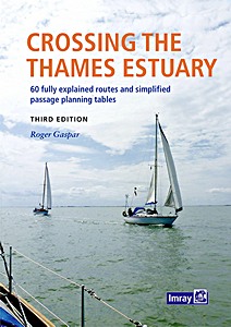
Crossing the Thames Estuary - 60 fully explained routes and simplified passage planning tables

The Thames Estuary is a complex and challenging area with narrow channels, shoal waters, determined tides and shifting sands, plus busy shipping traffic, three major ports and six wind farms in and around it. But its waters are also fascinating, interesting and have a wide selection of destinations to enjoy.
This book describes 60 safe, viable and feasible routes between the Kent, Essex and Suffolk rivers for safe passage and wholly new time-planning tables which are now simplified with significantly additional and readily available information.

The third edition retains all the popular features describing and illustrating each sector of each route, with waypoints and 'rolling road' diagrams, providing information and advice about potential or permanent hazards, the implications for the tide and guidance about shipping routes and anchorages.

Included are new and unique passage planning tables which are simple, accurate and quick to use. Readers can select the most appropriate start time and will instantly see predicted arrival time so as to have sufficient time to continue up river to an ultimate destination.
Options are offered for every 30 minutes of the day, whatever the day. The tables not only provide the best predicted start time - for the quickest passage duration - for each route at 4, 5, 6 or 7 knots boat speed, but display alternative passage durations, whatever the tide.

Tables provide easier access and a much broader basis of information than in earlier editions, presented alongside more detailed chartlets and a new portrait format book.
Sailors benefit from swatchways in the Estuary which shorten time and distance for many passages. However, as they're liable to move or change as sands shift, the author endeavours to survey several critical swatchways, monitors and provides illustrated Notices to Mariners weekly and receives reports from readers. Any significant changes or downloads are reported by updates on the website or by email to readers on the 'Readers' Update' list.

Detalle del libro

Autor:Roger Gaspar
Presentación:268 páginas, 30 x 22.5 x 2 cm, encuadernación en espiral
Ilustración:ricamente ilustrado con fotos y color y mapas
Idioma:Inglés
Editorial:Imray, Laurie, Norie & Wilson Ltd (GB, 2022)
ISBN:9781786793195
Portada del libro: Crossing the Thames Estuary - 60 fully explained routes and simplified passage planning tables | Imray

Crossing the Thames Estuary - 60 fully explained routes and simplified passage planning tables

Idioma: Inglés

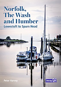
Norfolk, The Wash and Humber - Lowestoft to Spurn Head

Successor to Henry Irving's long-established guide to the nooks and crannies of this fascinating corner of the east coast of England, this new title has extended coverage under the authorship of retired harbourmaster and local cruising sailor Peter Harvey.
Some choose to bypass this beautiful section of coast and its extraordinary natural habitats, but this cruising guide gives inspiration to anyone who wishes to explore the many shallow creeks and deeper historic harbours of Norfolk, Lincolnshire and the Humber.

With thoroughly updated text and plans and new photographs throughout, The Wash and Humber remains an essential companion to this interesting and rewarding section of our coastline.

Detalle del libro

Autor:Peter Harvey
Presentación:96 páginas, 29.5 x 21 x 0.8 cm, tapa blanda
Ilustración:ricamente ilustrado con fotos y color y mapas
Idioma:Inglés
Editorial:Imray, Laurie, Norie & Wilson Ltd (GB, 2022)
ISBN:9781786791474
Portada del libro: Norfolk, The Wash and Humber - Lowestoft to Spurn Head | Imray

Norfolk, The Wash and Humber - Lowestoft to Spurn Head

Idioma: Inglés

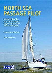
North Sea Passage Pilot - Routes between the east coast of England, Belgium, North France and The Netherlands

Readers of Imray's East Coast Pilot will need no introduction to Garth Cooper whose familiarity with North Sea passage-making is evident in the practical guidance he gives.
Under his authorship, this edition has been restructured to reflect the changing nature of passages across the North Sea. As well as a consideration of the various Traffic Separation Schemes, routes take into account the many new offshore windfarms and oil and gas extraction platforms.

As its name suggests, the emphasis of this pilot is on the passage routes, whether taking a more direct line between the UK and the Continent or incorporating hops along the East Coast and the adjacent coasts of France, Belgium and Holland.
Pilotage is included for a selection of key ports. Updated plans and numerous new photographs help to illustrate the key features to help guide you across this challenging yet rewarding stretch of water.

Detalle del libro

Autor:Garth Cooper
Presentación:232 páginas, 30 x 21 x 0.9 cm, tapa dura
Ilustración:ricamente ilustrado con fotos y color y mapas
Idioma:Inglés
Editorial:Imray, Laurie, Norie & Wilson Ltd (GB, 2022)
ISBN:9781786790668
Portada del libro: North Sea Passage Pilot - Routes between the east coast of England, Belgium, North France and The Netherlands | Imray

North Sea Passage Pilot - Routes between the east coast of England, Belgium, North France and The Netherlands

Idioma: Inglés

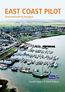
East Coast Pilot - Great Yarmouth to Ramsgate

East Coast Pilot has become the bible for cruising sailors for the waters between Great Yarmouth and Ramsgate. Not only does it cover the many harbours, rivers and creeks in a clear and concise manner, it also reveals some of the mysteries of sailing these shallow and shifting coastal waters.
Both authors keep their boats on the East Coast and are life-long lovers of the area. They maintain that every time they cast off and take to the water, they learn something new, adding to the considerable wealth of experience which they have passed on enthusiastically over many years.

For clarity and ease of reference the book is laid out in a logical sequence - each estuary, river and port has its own chapter which starts with the key information to get you in to that chosen destination. Box panels give key waypoints, port and harbour contact details, plus information about the main boating facilities a crew could need.
Further pages will entice you in as far as the limit of navigation. Essential information is backed up by Imray cartography, the authors' own sea-level photography giving you a clear view of what you should see, and aerial photographs which offer a useful visual perspective on what lies ahead.
Unique to East Coast Pilot are 'rolling road' diagrams to guide the approach. These were introduced to great acclaim in the first edition and show buoyage sequences and tracks to steer into rivers and ports.

Detalle del libro

Autor:Garth Cooper, Dick Holness
Presentación:168 páginas, 29.5 x 21 x 0.8 cm, tapa blanda
Ilustración:ricamente ilustrado con fotos y color y mapas
Idioma:Inglés
Editorial:Imray, Laurie, Norie & Wilson Ltd (GB, 2019)
ISBN:9781846239533
Portada del libro: East Coast Pilot - Great Yarmouth to Ramsgate | Imray

East Coast Pilot - Great Yarmouth to Ramsgate

Idioma: Inglés

Cook's Country - Spurn Head to St Abbs

A wholly original guide to the uniquely scenic and historic coasts of North Yorkshire and Northumberland. The author's fascinating personal insights complement information on all aspects of this stretch of coastline, making this an essential addition to any sailing library.

Páginas del libro Cook's Country - Spurn Head to St Abbs (1)

Páginas del libro "Cook's Country - Spurn Head to St Abbs"

Henry Irving has spent a lifetime sailing on the Humber and the Yorkshire coast, mostly on Venture, a Hull shrimper. He also sailed the William McCann, an old Hull steam trawler.

Detalle del libro

Autor:Henry Irving
Presentación:50 páginas, 29.5 x 21 x 0.5 cm, tapa blanda
Ilustración:ricamente ilustrado con fotos y color y mapas
Idioma:Inglés
Editorial:Imray, Laurie, Norie & Wilson Ltd (GB, 2016)
ISBN:9781846237492
Portada del libro: Cook's Country - Spurn Head to St Abbs | Imray

Cook's Country - Spurn Head to St Abbs

Idioma: Inglés

También te puede interesar:

Portada del libro: La Manche - Côtes française et anglaise et îles anglo-normandes et | Guide Imray Vagnon

La Manche - Côtes française et anglaise et îles anglo-normandes et

Tom Cunliffe | Francés | tapa blanda | 422 pág. | 2014

Portada del libro: Channel Islands, Cherbourg Peninsula, North Brittany

Channel Islands, Cherbourg Peninsula, North Brittany

RCC Pilotage Foundation, Peter Carnegie | Inglés | tapa dura | 2018